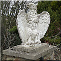
IMAGES TAKEN NEAR TO
Berryhillock, BUCKIE, AB56 5YA

Introduction

This page details the photographs taken nearby to Berryhillock, AB56 5YA by members of the Geograph project.

The Geograph project started in 2005 with the aim of publishing, organising and preserving representative images for every square kilometre of Great Britain, Ireland and the Isle of Man.

There are currently over 7.5m images from over14,400 individuals and you can help contribute to the project by visiting https://www.geograph.org.uk

Image Map


Images are licensed for reuse under creativecommons.org/licenses/by-sa/2.0
Notes
  • Clicking on the map will re-center to the selected point.
  • The higher the marker number, the further away the image location is from the centre of the postcode.

Image Listing (16 Images Found)

Images are licensed for reuse under creativecommons.org/licenses/by-sa/2.0
Image
Details
Distance
1
Berryhillock, Deskford
One of the larger groups of dwellings within the parish, the four whitewashed cottages are all from the early part of the 19th century and Listed Category C. The nearest was formerly 2 cottages, now one dwelling, the nearer 3-bay section formerly the Post Office. All the cottages bar the Post office are described in the Listings as having corrugated iron replacing or covering thatch, but all have since had this replaced with slate.
Image: © Alan Murray-Rust Taken: 23 May 2022
0.01 miles
2
Berryhillock
The street that makes up Berryhillock is a conservation area. Compare this with Image], taken eight years ago, and Image], taken eleven years ago.
Image: © Anne Burgess Taken: 9 Mar 2021
0.02 miles
3
Berryhillock
A pretty hamlet, with its curve of traditional cottages. Compare this view with Image] taken three years later. The hedge has been tamed, the broken rhone-pipes have been fixed, two of the planters have gone, the roses on the trellises have grown, and the ashlar corners and door and window surrounds have been painted in a contrasting colour.
Image: © Anne Burgess Taken: 23 Feb 2010
0.02 miles
4
Berryhillock
Settlement south of Cullen
Image: © Leslie Barrie Taken: 18 Jun 2013
0.03 miles
5
Burn of Deskford
Looking upstream from the road bridge at Berryhillock. The bank on the left has a good swathe of Snowdrops.
Image: © Anne Burgess Taken: 9 Mar 2021
0.03 miles
6
Corn Mill
The former corn mill is shown on the first edition of the Ordnance Survey six-inch map. It dates from the early 19th century and is a Category C Listed building.
Image: © Anne Burgess Taken: 9 Mar 2021
0.04 miles
7
Mill Lead
The lead or lade channelled the water from the mill dam not far away to power the mill wheel.
Image: © Anne Burgess Taken: 9 Mar 2021
0.05 miles
8
Mill Wheel
The overshot wheel still survives on the end gable of the old corn mill. Historic Environment Scotland notes that it is 'in poor condition'. See https://canmore.org.uk/site/95709/berryhillock-mill for more information.
Image: © Anne Burgess Taken: 9 Mar 2021
0.05 miles
9
Burn of Deskford
Looking downstream from the road bridge at Berryhillock. The right bank is carpeted with Snowdrops, and the left bank with the much less welcome invasive alien White Butterbur.
Image: © Anne Burgess Taken: 9 Mar 2021
0.06 miles
10
Ornate Gatepost
There's a bird-of-prey sculpture on each of the gateposts beside the entrance to Caroline Cottage.
Image: © Anne Burgess Taken: 9 Mar 2021
0.09 miles