IMAGES TAKEN NEAR TO
Drybridge, BUCKIE, AB56 5JY

Introduction

This page details the photographs taken nearby to AB56 5JY by members of the Geograph project.

The Geograph project started in 2005 with the aim of publishing, organising and preserving representative images for every square kilometre of Great Britain, Ireland and the Isle of Man.

There are currently over 7.5m images from over14,400 individuals and you can help contribute to the project by visiting https://www.geograph.org.uk

Image Map


Images are licensed for reuse under creativecommons.org/licenses/by-sa/2.0
Notes
  • Clicking on the map will re-center to the selected point.
  • The higher the marker number, the further away the image location is from the centre of the postcode.

Image Listing (9 Images Found)

Images are licensed for reuse under creativecommons.org/licenses/by-sa/2.0
Image
Details
Distance
1
Waymarker
The waymarker indicates the route of the Fishwives' Path.
Image: © Anne Burgess Taken: 19 Aug 2022
0.11 miles
2
Bluebells (Campanula rotundifolia)
These are the Bluebells of Scotland, known in England as Harebells.
Image: © Anne Burgess Taken: 19 Aug 2022
0.12 miles
3
Bluebells (Campanula rotundifolia)
These are the Bluebells of Scotland, known in England as Harebells.
Image: © Anne Burgess Taken: 19 Aug 2022
0.12 miles
4
Stoneybank
A newish house just at the end of the public road. The trees beside it are in the glen of the Burn of Letterfourie.
Image: © Anne Burgess Taken: 8 Oct 2020
0.14 miles
5
Hillhead of Letterfourie
The modern steading is a little way from the farm here.
Image: © Anne Burgess Taken: 24 Aug 2006
0.19 miles
6
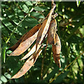
Vetch Pods
I think these are the seed pods of Bush Vetch (Vicia sepium) but they might be Tufted Vetch (Vicia cracca).
Image: © Anne Burgess Taken: 8 Oct 2020
0.20 miles
7
Hillhead of Letterfourie
The large and busy yard at Hillhead is a little distance downhill from the farm itself.
Image: © Anne Burgess Taken: 8 Oct 2020
0.21 miles
8
Drainage Ditch
The ditch is well overgrown and no doubt full of botanical interest. The trees at the far end are in the glen of the Burn of Letterfourie.
Image: © Anne Burgess Taken: 8 Oct 2020
0.22 miles
9
Fields of Barley
Barley getting close to being ready for harvesting. The large shed is at Greenbank, and in the distance are Buckie, the Moray Firth, and the hills of Caithness.
Image: © Anne Burgess Taken: 19 Aug 2022
0.25 miles