
IMAGES TAKEN NEAR TO
BUCKIE, AB56 5BD
Introduction
This page details the photographs taken nearby to AB56 5BD by members of the Geograph project.
The Geograph project started in 2005 with the aim of publishing, organising and preserving representative images for every square kilometre of Great Britain, Ireland and the Isle of Man.

There are currently over 7.5m images from over14,400 individuals and you can help contribute to the project by visiting https://www.geograph.org.uk
Image Map
Images are licensed for reuse under creativecommons.org/licenses/by-sa/2.0
Notes
- Clicking on the map will re-center to the selected point.
- The higher the marker number, the further away the image location is from the centre of the postcode.
Image Listing (4 Images Found)
Images are licensed for reuse under creativecommons.org/licenses/by-sa/2.0
Image
Details
Distance
1
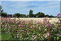
Auchentae
The farm house at Auchintae is partially screened by trees, and by the row of the invasive alien Indian Balsam (Impatiens gladulifera) lining the roadside.
Image: © Anne Burgess
Taken: 9 Aug 2020
0.00 miles
2
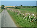
Old lady walking in lane
Photographed from just before Auchentae looking down the lane towards the Burn of Gallochy. The flowers on the right are I was told (by the lady walking up the hill) Japanese Hog weed, "pretty to look at but an invasive nuisance which grows in any damp ground available".
Image: © Mark Walton
Taken: 28 Jul 2008
0.17 miles
3
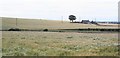
Barley Field
Barley turning golden at Auchintae. In the background is Damhead
Image: © Anne Burgess
Taken: 18 Jul 2006
0.20 miles
4
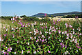
Wayside at Auchintae
The side of the road at Auchintae is lined by Himalayan Balsam (Impatiens glandulifera) in all shades of pink. This is not altogether a welcome sight because it is an aggressively invasive alien. The hill on the skyline is the Bin of Cullen and the house with the turret is Tigh na Solus.
Image: © Anne Burgess
Taken: 9 Aug 2020
0.24 miles