
IMAGES TAKEN NEAR TO
Findlater Circle, BUCKIE, AB56 4RY
Introduction
This page details the photographs taken nearby to Findlater Circle, AB56 4RY by members of the Geograph project.
The Geograph project started in 2005 with the aim of publishing, organising and preserving representative images for every square kilometre of Great Britain, Ireland and the Isle of Man.

There are currently over 7.5m images from over14,400 individuals and you can help contribute to the project by visiting https://www.geograph.org.uk
Image Map
Images are licensed for reuse under creativecommons.org/licenses/by-sa/2.0
Notes
- Clicking on the map will re-center to the selected point.
- The higher the marker number, the further away the image location is from the centre of the postcode.
Image Listing (8 Images Found)
Images are licensed for reuse under creativecommons.org/licenses/by-sa/2.0
Image
Details
Distance
1
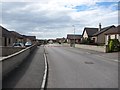
Findlater Drive
Newish housing on the edge of Cullen.
Image: © Richard Webb
Taken: 5 Aug 2011
0.04 miles
2
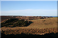
Cullen from Crannoch Hill
A wider view across the Howe of Gillfurry takes in not only the southern outskirts of Cullen, but a view to seaward right round to the Bow Fiddle Rock at far right, though from this angle you don't see the distinctive shape of the rock. The route of the former Great North of Scotland Railway runs through the cutting at left and can be traced passing on this side of Seafield Farm.
Image: © Anne Burgess
Taken: 20 Jan 2011
0.05 miles
4
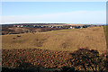
Cullen from Crannoch Hill
Looking across the Howe of Gillyfurry to the southern outskirts of Cullen. The white gable with chimney towards the right-hand side is Seafield Farm. Portknockie is visible in the distance on the right.
Image: © Anne Burgess
Taken: 20 Jan 2011
0.16 miles
5
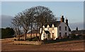
Seafield Farm
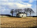
Late afternoon light catches the farm house at Seafield Farm, which stands just off the A98 at the approach to Cullen from the south and east. It is a fine example of a traditional 18th century farm house.
Image: © Anne Burgess
Taken: 19 Mar 2010
0.22 miles
7
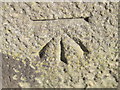
Ordnance Survey Cut Mark
This can be found on the roadside boundary wall of the Community Centre.
For more detail see : http://www.bench-marks.org.uk/bm45908
Image: © Peter Wood
Taken: 5 Oct 2012
0.24 miles
8
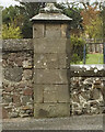
Column with OS Cut Mark, Seafield Road
Column with OS Cut Mark, Seafield Road - roadside and easy to spot
Image: © thejackrustles
Taken: 3 May 2015
0.24 miles