
IMAGES TAKEN NEAR TO
Park Street, BUCKIE, AB56 4LT
Introduction
This page details the photographs taken nearby to Park Street, AB56 4LT by members of the Geograph project.
The Geograph project started in 2005 with the aim of publishing, organising and preserving representative images for every square kilometre of Great Britain, Ireland and the Isle of Man.

There are currently over 7.5m images from over14,400 individuals and you can help contribute to the project by visiting https://www.geograph.org.uk
Image Map
Images are licensed for reuse under creativecommons.org/licenses/by-sa/2.0
Notes
- Clicking on the map will re-center to the selected point.
- The higher the marker number, the further away the image location is from the centre of the postcode.
Image Listing (131 Images Found)
Images are licensed for reuse under creativecommons.org/licenses/by-sa/2.0
Image
Details
Distance
1
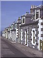
Seafield Street
This is a most unusual view, because there are normally cars parked along both sides of the street. These houses, all alike and more elaborate than the traditional cottages closer to the cliff top, are a testimony to the prosperity of former times, when the fishing was at its height.
Image: © Anne Burgess
Taken: 18 Jun 1983
0.02 miles
2
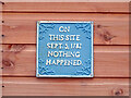
Portknockie Humour
A quirky sign on a shed in Portknockie. It is a very quiet and peaceful place - in fact nothing happened on 13th September 2022 either!
Image: © Adam Ward
Taken: 13 Sep 2022
0.03 miles
5
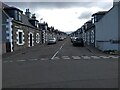
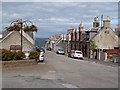
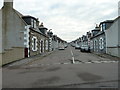
Portknockie Streets
Traditional fishing port housing, although the fishing has mostly long gone.
Image: © Robert Struthers
Taken: 15 Oct 2020
0.04 miles
6
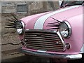
A glamorous mini in Portknockie
This pink mini with long black headlamp eye lashes was parked in New Street. For a wider view of this street, see Image
Image: © Walter Baxter
Taken: 10 Sep 2013
0.04 miles
8
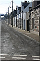
Reidhaven Street
It's unusual to see a street devoid of parked cars, but I was lucky today. There were two on the left-hand side, but the only movement was the postie delivering the letters.
Image: © Anne Burgess
Taken: 17 Feb 2011
0.05 miles
9
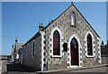
Church of Christ
This is marked on the second edition of the Ordnance Survey six-inch map as 'Baptist Hall', and at that time it was the only building on the east side of Seafield Street. It does not appear on the first edition, however.
Image: © Anne Burgess
Taken: 24 Jul 2014
0.05 miles
10
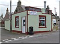
Portknockie Fish and Chip Shop
The chip shop is located in Bridge Street.
Image: © Walter Baxter
Taken: 10 Sep 2013
0.05 miles