
IMAGES TAKEN NEAR TO
BUCKIE, AB56 4ED
Introduction
This page details the photographs taken nearby to AB56 4ED by members of the Geograph project.
The Geograph project started in 2005 with the aim of publishing, organising and preserving representative images for every square kilometre of Great Britain, Ireland and the Isle of Man.

There are currently over 7.5m images from over14,400 individuals and you can help contribute to the project by visiting https://www.geograph.org.uk
Image Map
Images are licensed for reuse under creativecommons.org/licenses/by-sa/2.0
Notes
- Clicking on the map will re-center to the selected point.
- The higher the marker number, the further away the image location is from the centre of the postcode.
Image Listing (6 Images Found)
Images are licensed for reuse under creativecommons.org/licenses/by-sa/2.0
Image
Details
Distance
1
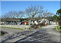
Georgetown and Sycamore Grove
The 19th century maps show a farm here called Georgetown. This has evidently been replaced by two modern bungalows, one of which retains the old name.
Image: © Anne Burgess
Taken: 3 Apr 2021
0.01 miles
3
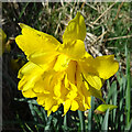
Double-flowered Daffodil
One of the flowers in a clump beside the road.
Image: © Anne Burgess
Taken: 3 Apr 2021
0.17 miles
4
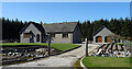
West Bank
This new house is on the site of an older farm that is shown on the 19th century maps.
Image: © Anne Burgess
Taken: 3 Apr 2021
0.18 miles
5

Whins (Ulex europaeus)
In full bloom in June, the whins (called gorse in England) cover the land with colour and the air with their coconut-like scent.
Image: © Anne Burgess
Taken: 13 Jun 2006
0.19 miles
6
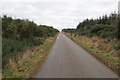
Minor Road at Bauds of Cullen
Having walked the length of this long, straight road, it seemed to on for ever.
Image: © Alan hodgson
Taken: 19 Jan 2016
0.21 miles