
IMAGES TAKEN NEAR TO
Anton Street, BUCKIE, AB56 1RS
Introduction
This page details the photographs taken nearby to Anton Street, AB56 1RS by members of the Geograph project.
The Geograph project started in 2005 with the aim of publishing, organising and preserving representative images for every square kilometre of Great Britain, Ireland and the Isle of Man.

There are currently over 7.5m images from over14,400 individuals and you can help contribute to the project by visiting https://www.geograph.org.uk
Image Map
Images are licensed for reuse under creativecommons.org/licenses/by-sa/2.0
Notes
- Clicking on the map will re-center to the selected point.
- The higher the marker number, the further away the image location is from the centre of the postcode.
Image Listing (25 Images Found)
Images are licensed for reuse under creativecommons.org/licenses/by-sa/2.0
Image
Details
Distance
7
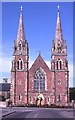
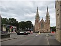
St Peter's Church
This is Buckie's Roman Catholic church, built in 1857.
Image: © Anne Burgess
Taken: 21 Jul 1983
0.20 miles
9
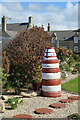
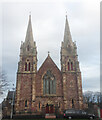
Recycled Lighthouse?
Someone has enjoyed creating this garden feature from old tyres.
Image: © Anne Burgess
Taken: 30 Apr 2021
0.21 miles
10
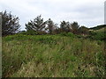
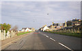
Buckpool railway station (site), Moray
Opened in 1886 as "Nether Buckpool" by the Great North of Scotland Railway on the line from Tillynaught to Elgin, this station was renamed after just a few months to "Buckpool". It closed in 1960, some 8 years before the line closed, and was demolished.
View north east towards Buckie GNS and Tillynaught. The station site was part overgrown wasteland and (beyond the trees) part housing, when this image was taken, and bears little relation to Image taken in the opposite direction some 58 years earlier.
Image: © Nigel Thompson
Taken: 5 Sep 2019
0.21 miles