
IMAGES TAKEN NEAR TO
East Church Street, BUCKIE, AB56 1ES
Introduction
This page details the photographs taken nearby to East Church Street, AB56 1ES by members of the Geograph project.
The Geograph project started in 2005 with the aim of publishing, organising and preserving representative images for every square kilometre of Great Britain, Ireland and the Isle of Man.

There are currently over 7.5m images from over14,400 individuals and you can help contribute to the project by visiting https://www.geograph.org.uk
Image Map
Images are licensed for reuse under creativecommons.org/licenses/by-sa/2.0
Notes
- Clicking on the map will re-center to the selected point.
- The higher the marker number, the further away the image location is from the centre of the postcode.
Image Listing (151 Images Found)
Images are licensed for reuse under creativecommons.org/licenses/by-sa/2.0
Image
Details
Distance
1
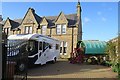
Camping now and then
On the right, a traditional horse-drawn waggon of the sort traditionally associated with gipsies. On the left, by way of contract, a modern campervan.
Image: © Anne Burgess
Taken: 13 Oct 2017
0.01 miles
2
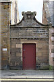
Alley Gateway
I'de never noticed this before - and I have no idea why a gateway built in 1902 should have a scallop shell carved above the door.
Image: © Anne Burgess
Taken: 15 Apr 2022
0.02 miles
3
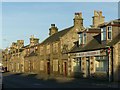
North Church Street, Buckie
In warm late afternoon sunlight.
Image: © Alan Murray-Rust
Taken: 19 Sep 2019
0.02 miles
4
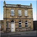
Former Register Office
This building was originally the General Register Office, built in 1920-1921.
Image: © Anne Burgess
Taken: 13 Oct 2017
0.03 miles
5
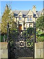
Iron Gate
One of two matching gates in the garden wall of Bay-View, a good solid stone Victorian villa.
Image: © Anne Burgess
Taken: 13 Oct 2017
0.03 miles
6
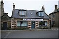
Buckie Alterations
Buckie Tailoring & Alterations on East Church Street.
Image: © Richard Sutcliffe
Taken: 18 Oct 2023
0.03 miles
7
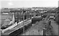
Buckie (GNS) Station
View eastward, towards Portessie, Cullen and eventually round to Cairnie Junction; ex-Great North of Scotland line, Cairnie Junction via coast to Elgin, closed completely on 6/5/68. (Until 9/8/15 there had been another Buckie Station (off to the right) on a Highland Rly branch from Keith to Portessie).
Image: © Ben Brooksbank
Taken: 2 Oct 1961
0.03 miles
8
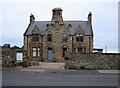
Former Manse, East Church Street
The building was originally built as the Free Church of Scotland manse and there is a date stone of 1843 above a ground floor window, which coincides with the breakaway of the Free Church from the established Church of Scotland at that time. There is also a date stone set higher up for 1887. This may have been when the building was altered.
It is now a private residence.
Image: © Richard Sutcliffe
Taken: 18 Oct 2023
0.03 miles
9
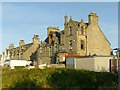
Former Free Kirk Manse, Buckie
This is the seaward side of the house seen in https://www.geograph.org.uk/photo/5570956 . The distinctive Scottish styling has not been stinted on the rear of the building.
Image: © Alan Murray-Rust
Taken: 19 Sep 2019
0.03 miles
10
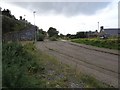
Buckie GNS railway station (site), Moray
Opened in 1886 by the Great North of Scotland Railway on the line from Tillynaught to Elgin, this station closed in 1968 and was largely demolished.
View south west towards Buckpool and Elgin. The support for the footbridge was still in place when this image was taken, which can be seen looking in the opposite direction some 58 years previously on Image A footpath now runs through the site.
Image: © Nigel Thompson
Taken: 5 Sep 2019
0.04 miles