IMAGES TAKEN NEAR TO
Crossroads, KEITH, AB55 6LP
Introduction
This page details the photographs taken nearby to AB55 6LP by members of the Geograph project.
The Geograph project started in 2005 with the aim of publishing, organising and preserving representative images for every square kilometre of Great Britain, Ireland and the Isle of Man.

There are currently over 7.5m images from over14,400 individuals and you can help contribute to the project by visiting https://www.geograph.org.uk
Image Map
Images are licensed for reuse under creativecommons.org/licenses/by-sa/2.0
Notes
- Clicking on the map will re-center to the selected point.
- The higher the marker number, the further away the image location is from the centre of the postcode.
Image Listing (5 Images Found)
Images are licensed for reuse under creativecommons.org/licenses/by-sa/2.0
Image
Details
Distance
1
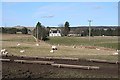
Mid Paithnick
The white south-facing farm house is hidden from almost all angles by its sheltering trees. The feeding troughs in the foreground are for a flock of ewes due to lamb fairly soon.
Image: © Anne Burgess
Taken: 6 Mar 2009
0.02 miles
2
Loanhead
Looking across to some of the many new houses which have sprung up near Loanhead Cottage, the nearest one, partly obscured in this view by a brown hedge.
Image: © Anne Burgess
Taken: 6 Mar 2009
0.14 miles
3
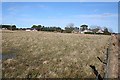
Loanhead Cottage
Loanhead is the cottage to the right here, just beside the N9018. Beyond and to the west (left) are numerous modern houses, mostly with non-traditional names.
Image: © Anne Burgess
Taken: 6 Mar 2009
0.17 miles
4

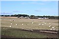
Rainbow at Mid Paithnick
Between snow showers a brief period of sunlight produced a Rainbow on an otherwise bleak and cold day.
Image: © Alastair Young
Taken: 31 Jan 2010
0.17 miles
5
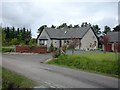
Kylerhea House near B9018.
This new house is situated close to B9018 Keith to Cullen road.
Image: © Christopher Gillan
Taken: 29 May 2006
0.19 miles