IMAGES TAKEN NEAR TO
KEITH, AB55 5PE
Introduction
This page details the photographs taken nearby to AB55 5PE by members of the Geograph project.
The Geograph project started in 2005 with the aim of publishing, organising and preserving representative images for every square kilometre of Great Britain, Ireland and the Isle of Man.

There are currently over 7.5m images from over14,400 individuals and you can help contribute to the project by visiting https://www.geograph.org.uk
Image Map
Images are licensed for reuse under creativecommons.org/licenses/by-sa/2.0
Notes
- Clicking on the map will re-center to the selected point.
- The higher the marker number, the further away the image location is from the centre of the postcode.
Image Listing (5 Images Found)
Images are licensed for reuse under creativecommons.org/licenses/by-sa/2.0
Image
Details
Distance
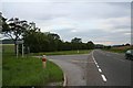
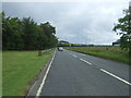
4
Road towards Blackmuir
Heading east from the A96.
Image: © JThomas
Taken: 20 Jul 2014
0.12 miles
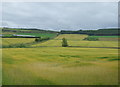
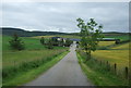
5
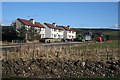
Backmuir Cottages
These were originally council houses, built to the same design as the ones at Loanend and Stripeside.
Image: © Anne Burgess
Taken: 25 Feb 2009
0.20 miles