1
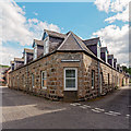
Craigellachie and Aberlour church
Image: © Callum Black
Taken: 27 Oct 2006
0.01 miles
2
Broomfield Square Charleston of Aberlour
Image: © valenta
Taken: 15 Jun 2018
0.03 miles
3
The Mash Tun
Lying near the old station at Aberlour. The plaque above the door indicates the hotel was built in 1896 for TC (Thomas Campbell, a sea capain). See http://www.whisky-pages.com/stories/the-mash-tun.htm
Image: © Andrew Wood
Taken: 30 Mar 2009
0.03 miles
4
Aberlour High Street
Image: © Jennifer Jones
Taken: 30 Apr 2014
0.03 miles
5
The Mash Tun
9 Broomfield Square, Charlestown of Aberlour, close to the River Spey.
Image: © jeff collins
Taken: 30 Sep 2013
0.04 miles
6
The Mash Tun
The former Station Bar is a Category C Listed Building. See http://portal.historicenvironment.scot/designation/LB49987. The Mash Tun's own web site https://www.mashtun-aberlour.com/about-us says, "The building was originally constructed in 1896 by James Campbell, a sea captain, who instructed a marine architect to design the building in the shape of a small ship. A pledge contained in the title deeds, made in 1963 by the owner at the time, states that since Dr Beeching closed the railway in Aberlour then a name change was appropriate - but that if ever a train should pull up at the station again then the pub will revert to the Station Bar".
Image: © Anne Burgess
Taken: 20 Jan 2022
0.04 miles
7
The Mash Tun
Public house dated 1896, formerly the Old Station Bar. It is Category C listed https://portal.historicenvironment.scot/designation/LB49987.
Image: © Richard Sutcliffe
Taken: 17 Oct 2023
0.04 miles
8
Drill Hall
This building looks so different from most of the gothic late Victorian drill halls that, had it not been for a small plaque by the door, I would probably not have realised that that is what it is. It was designed by Thomas Mackenzie (1814-1854) but probably not actually built until after his death. Its original purpose was a school, but after a new school was built in 1905 it became the drill hall.
Image: © Anne Burgess
Taken: 10 Apr 2014
0.04 miles
9
Drill Hall
This building looks so different from most of the gothic late Victorian drill halls that, had it not been for a small plaque by the door, I would probably not have realised that that is what it is. It was designed by Thomas Mackenzie (1814-1854) but probably not actually built until after his death. Its original purpose was a school, but after a new school was built in 1905 it became the drill hall. The bell that used to hang in the little belfry on the left is now in Aberlour Primary School.
Image: © Anne Burgess
Taken: 10 Apr 2014
0.04 miles
10
Bridge over the old railway track, Aberlour.
The old railway track is now part of the Speyside Way, one of Scotland's four official long walks. The route is 84 miles long and links the Cairngorm Mountains to the Moray Firth Coast. The tower in the background is part of Aberlour Parish Church; a Norman style building, situated in the village square. It is owned by The Church of Scotland and was rebuilt after a fire in 1861.
Image: © David Smith
Taken: 24 Mar 2008
0.04 miles


