
IMAGES TAKEN NEAR TO
Rosemount Place, ABERDEEN, AB25 2UX
Introduction
This page details the photographs taken nearby to Rosemount Place, AB25 2UX by members of the Geograph project.
The Geograph project started in 2005 with the aim of publishing, organising and preserving representative images for every square kilometre of Great Britain, Ireland and the Isle of Man.

There are currently over 7.5m images from over14,400 individuals and you can help contribute to the project by visiting https://www.geograph.org.uk
Image Map
Images are licensed for reuse under creativecommons.org/licenses/by-sa/2.0
Notes
- Clicking on the map will re-center to the selected point.
- The higher the marker number, the further away the image location is from the centre of the postcode.
Image Listing (156 Images Found)
Images are licensed for reuse under creativecommons.org/licenses/by-sa/2.0
Image
Details
Distance
1
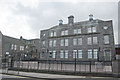
Storm brewing over Skene Square Primary School
One of several large granite buildings on the sprawling site. The date-stone on the chimney breast reads 1919.
Image: © Bill Harrison
Taken: 5 Oct 2008
0.03 miles
3
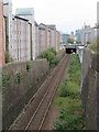
Railway line in Aberdeen
A single track railway line close to the centre of Aberdeen. This line is used by passenger services between Aberdeen and Dyce, and stations beyond as far as Inverness.
Image: © Malc McDonald
Taken: 29 Apr 2023
0.03 miles
5
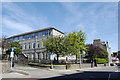
Skene Square Primary School (view from Rosemount Place)
Another example of the massive, granite, three-storey design of Aberdeen primary schools of the early 1900s [compare Kittybrewster http://www.geograph.org.uk/photo/918013 , Hanover Street http://www.geograph.org.uk/photo/3017222 , Frederick Street (now closed) http://www.geograph.org.uk/photo/3017252 , Mile End (now closed) http://www.geograph.org.uk/photo/866076 and Causewayend (now closed) http://www.geograph.org.uk/photo/852307 ].
Image: © Bill Harrison
Taken: 3 Aug 2012
0.04 miles
6
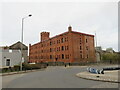
The Bastille, Aberdeen
The Bastille is a former flax warehouse in Aberdeen, built in the early 20th Century. It has now been converted into residential apartments.
Image: © Malc McDonald
Taken: 29 Apr 2023
0.04 miles
7
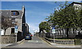
A look down Forbes Street...
... with a small corner of Skene Square Primary School to the right.
Image: © Bill Harrison
Taken: 3 Aug 2012
0.04 miles
8
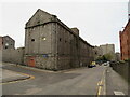
Maberly Street, Aberdeen
A view of Maberly Street in Aberdeen. The derelict building on the opposite side of the road is part of a former textile mill. There are plans to regenerate the site for residential and retail use.
Image: © Malc McDonald
Taken: 29 Apr 2023
0.05 miles
9
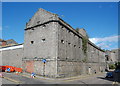
Broadford Works, Maberly Street, Aberdeen
The southeast corner of the massive A-listed textile complex (see: http://www.britishlistedbuildings.co.uk/sc-43908-maberly-street-broadford-works-with-retur ), which was once Aberdeen's single largest employer.
Image: © Bill Harrison
Taken: 12 Apr 2014
0.05 miles
10
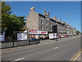
Skene Square, Aberdeen
Skene Square is not really a square at all...
Image: © Bill Harrison
Taken: 25 May 2013
0.05 miles