
IMAGES TAKEN NEAR TO
Gallowgate, ABERDEEN, AB25 1DX
Introduction
This page details the photographs taken nearby to Gallowgate, AB25 1DX by members of the Geograph project.
The Geograph project started in 2005 with the aim of publishing, organising and preserving representative images for every square kilometre of Great Britain, Ireland and the Isle of Man.

There are currently over 7.5m images from over14,400 individuals and you can help contribute to the project by visiting https://www.geograph.org.uk
Image Map
Images are licensed for reuse under creativecommons.org/licenses/by-sa/2.0
Notes
- Clicking on the map will re-center to the selected point.
- The higher the marker number, the further away the image location is from the centre of the postcode.
Image Listing (333 Images Found)
Images are licensed for reuse under creativecommons.org/licenses/by-sa/2.0
Image
Details
Distance
1
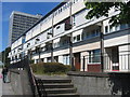
Those white flats on Gallowgate...
I think that they are sheltered flats for the elderly.
Image: © Bill Harrison
Taken: 9 Jun 2010
0.01 miles
2
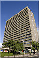
Seamount Court
One of Aberdeen's biggest 1960s towerblocks catches the evening sun.
Image: © Bill Harrison
Taken: 20 Jun 2008
0.02 miles
3
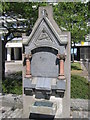
Archibald Reith Memorial
This part of Aberdeen was massively redeveloped in the 1960s in the name of "slum clearance." Almost nothing remains except this memorial to Archibald Reith, a 19th Century cleric who established a (now demolished) school in the area. It reads: To / the memory of / Archibald Reith MD / founder and superintendent of this school / who entered into rest 30 December 189X / in his 58th year. / Consecrating in early manhood the gift(?) / of a rich and generous nature to the service / of his lord. He devoted himself for 34 years to / the spiritual and moral well-being of the young / people of this neighbourhood with single hearted / enthusiasm and self-sacrificing love. / By his exertions and according to his / plans this building was erected in 1874. A brass tablet on the base of the memorial notes that it was resited here in 1960 when Porthill Sunday School was demolished. Note added: I believe that it also marks the approximate location of the demolished Gallowgate United Free Church.
Image: © Bill Harrison
Taken: 9 Jun 2010
0.02 miles
4
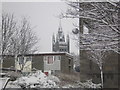
Marischal College and council flats
Snowy scene from Gallowgate, looking across towards Marischal College.
Image: © Charlotte Lunn
Taken: 22 Dec 2009
0.02 miles
5
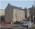
Gallowgate survivor
Thought to date from the early 19th Century, and for many years a school. Almost every other building on the east side of the Gallowgate was demolished in the 1960s. The building is C-listed: http://data.historic-scotland.gov.uk/pls/htmldb/f?p=2200:15:0::::BUILDING:50053 .
Image: © Bill Harrison
Taken: 1 Feb 2015
0.02 miles
6
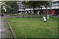
Turf Zone "PorthillZone"
At Porthill Court, Gallowgate, Aberdeen.
Image: © Ian S
Taken: 4 Oct 2022
0.03 miles
7
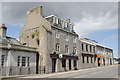
The Blue Lamp, Gallowgate, Aberdeen
Formerly a police station, now an artsy pub, which frequently hosts jazz and folk music concerts and the like.
Image: © Bill Harrison
Taken: 30 Jun 2012
0.03 miles
8
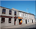
Granite buildings, Gallowgate, Aberdeen
Image: © Bill Harrison
Taken: 13 Aug 2016
0.03 miles
9
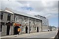
Business units, Gallowgate, Aberdeen
Nicely cleaned and restored. Aberdeen College looms behind.
Image: © Bill Harrison
Taken: 30 Jun 2012
0.03 miles
10
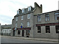
The Blue Lamp, Gallowgate, Aberdeen
A pub and music venue. The name might suggest a former police station, but I don't think that's the case.
Image: © Stephen Craven
Taken: 3 Jul 2019
0.03 miles