
IMAGES TAKEN NEAR TO
Gallowgate, ABERDEEN, AB25 1BY
Introduction
This page details the photographs taken nearby to Gallowgate, AB25 1BY by members of the Geograph project.
The Geograph project started in 2005 with the aim of publishing, organising and preserving representative images for every square kilometre of Great Britain, Ireland and the Isle of Man.

There are currently over 7.5m images from over14,400 individuals and you can help contribute to the project by visiting https://www.geograph.org.uk
Image Map
Images are licensed for reuse under creativecommons.org/licenses/by-sa/2.0
Notes
- Clicking on the map will re-center to the selected point.
- The higher the marker number, the further away the image location is from the centre of the postcode.
Image Listing (501 Images Found)
Images are licensed for reuse under creativecommons.org/licenses/by-sa/2.0
Image
Details
Distance
1
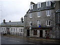
Buildings on Gallowgate
Offices (formerly Ogston & Stamp) on the left; a shop to the right. The latter shows signs of once being both a pub (McEwans sign), and a cop shop (blue lamp)!
Image: © Stanley Howe
Taken: 8 Apr 2009
0.02 miles
2
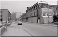
Gallowgate, Aberdeen
The old Northern Co-operative Society Limited building is boarded up on the right in this view taken in 1979.
Image: © Richard Sutcliffe
Taken: Unknown
0.02 miles
3
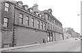
Gallowgate, Aberdeen
The old Northern Co-operative Society Limited building is boarded up in this view taken in 1979.
Image: © Richard Sutcliffe
Taken: Unknown
0.02 miles
4
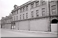
Gallowgate, Aberdeen
The old Northern Co-operative Society Limited building is boarded up in this view taken in 1979.
Image: © Richard Sutcliffe
Taken: Unknown
0.02 miles
5

Driving past the Blue Lamp (Gallowgate, Aberdeen)
Viewed down Seamount Road
Image: © Bill Harrison
Taken: 30 Jun 2012
0.02 miles
6

Former VSA (Voluntary Service Aberdeen) shop
Image: © Bill Harrison
Taken: 9 Jun 2010
0.03 miles
7
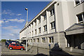
Greyfriars House
This modern block is home to important -- but not necessarily popular --
bureaucracies such as the DVLA and HM Inspectorate of Education.
Image: © Bill Harrison
Taken: 20 Jun 2008
0.03 miles
8

Former Ogston and Tennant offices, Gallowgate, Aberdeen
Built 1922 as the main office of the soap-works and it even has its own Wikipedia page... http://en.wikipedia.org/wiki/The_Soap_Factory
Image: © Bill Harrison
Taken: 1 Mar 2014
0.03 miles
9
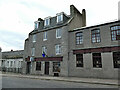
The Blue Lamp, Gallowgate, Aberdeen
A pub and music venue. The name might suggest a former police station, but I don't think that's the case.
Image: © Stephen Craven
Taken: 3 Jul 2019
0.03 miles
10

The Blue Lamp, Gallowgate, Aberdeen - detail
The blue lamp itself may have come from a former police station. The other sign is for McEwan's brewery. See Image for context.
Image: © Stephen Craven
Taken: 3 Jul 2019
0.03 miles