IMAGES TAKEN NEAR TO
Merkland Road East, ABERDEEN, AB24 5PR
Introduction
This page details the photographs taken nearby to Merkland Road East, AB24 5PR by members of the Geograph project.
The Geograph project started in 2005 with the aim of publishing, organising and preserving representative images for every square kilometre of Great Britain, Ireland and the Isle of Man.

There are currently over 7.5m images from over14,400 individuals and you can help contribute to the project by visiting https://www.geograph.org.uk
Image Map
Images are licensed for reuse under creativecommons.org/licenses/by-sa/2.0
Notes
- Clicking on the map will re-center to the selected point.
- The higher the marker number, the further away the image location is from the centre of the postcode.
Image Listing (128 Images Found)
Images are licensed for reuse under creativecommons.org/licenses/by-sa/2.0
Image
Details
Distance
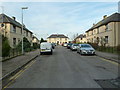
1
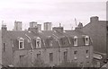
Back of properties on Merkland Road East
Looking north-northeast from a top-floor flat on King Street.
Image: © Richard Sutcliffe
Taken: Unknown
0.03 miles
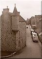
2
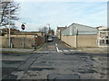
Pittodrie Lane, Aberdeen
This might be called "mews" in London...
Image: © Bill Harrison
Taken: 19 Nov 2011
0.04 miles
3
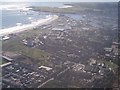
Aberdeen from above
On our way back from Shetland.
Image: © Bob Embleton
Taken: 22 Aug 2004
0.06 miles
4
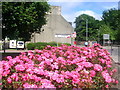
Roses at Mounthooly
Display of roses, near Mounthooly roundabout, on the road to Old Aberdeen.
Image: © Richard Slessor
Taken: 21 Jul 2005
0.06 miles
5
A glimpse down Erroll Place, Aberdeen
Image: © Bill Harrison
Taken: 19 Nov 2011
0.07 miles
7
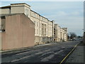
Flats, Pittodrie Street, Aberdeen
One of numerous modern complexes to the east of King Street.
Image: © Bill Harrison
Taken: 19 Nov 2011
0.08 miles
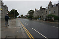
9
Corner of King Street and St Peter Street
The building on the corner is part of the Category C listed Public Transport Department building, a former Militia barracks, dating from 1861-63.
Image: © Richard Sutcliffe
Taken: Unknown
0.09 miles
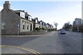
10
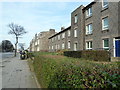
King Street dwellings
King Street, the main route to the north, dates from about 1805.
Image: © Bill Harrison
Taken: 19 Nov 2011
0.09 miles