
IMAGES TAKEN NEAR TO
Roslin Place, ABERDEEN, AB24 5NW
Introduction
This page details the photographs taken nearby to Roslin Place, AB24 5NW by members of the Geograph project.
The Geograph project started in 2005 with the aim of publishing, organising and preserving representative images for every square kilometre of Great Britain, Ireland and the Isle of Man.

There are currently over 7.5m images from over14,400 individuals and you can help contribute to the project by visiting https://www.geograph.org.uk
Image Map
Images are licensed for reuse under creativecommons.org/licenses/by-sa/2.0
Notes
- Clicking on the map will re-center to the selected point.
- The higher the marker number, the further away the image location is from the centre of the postcode.
Image Listing (60 Images Found)
Images are licensed for reuse under creativecommons.org/licenses/by-sa/2.0
Image
Details
Distance
1

Rhodesia Buildings, Urquhart Road, Aberdeen
The four-storey terrace has 1909 on the datestone.
Image: © Bill Harrison
Taken: 12 May 2013
0.12 miles
2
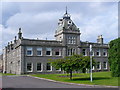
Aberdeen - City Hospital
Impressive range of granite buildings facing on to Urquhart Road. Building began here in 1874 following smallpox outbreaks in the city.
Image: © Colin Smith
Taken: 25 Jul 2010
0.12 miles
3
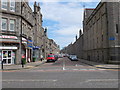
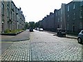
Looking down Urquhart Street, Aberdeen
Lots of student flats...
Image: © Bill Harrison
Taken: 12 May 2013
0.14 miles
4
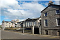
Former St Peter's RC Primary School, Constitution Street, Aberdeen
Dating from 1833, this former primary school is an early and interesting feature of Catholic emancipation in Aberdeen, following the 1829 relief Act: http://en.wikipedia.org/wiki/Roman_Catholic_Relief_Act_1829 . The street name is ironic, as it was apparently inspired by a speech by George III opposing Catholic emancipation. For more of the building's history, check its B-listing: http://www.britishlistedbuildings.co.uk/sc-20238-constitution-street-beach-court-care-home . It was derelict in the 1990s and converted into a care home.
Image: © Bill Harrison
Taken: 16 Aug 2014
0.14 miles
5
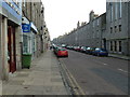
Urquhart Road, Aberdeen
Granite and satellite dishes as far as the eye can see...
Image: © Bill Harrison
Taken: 19 Nov 2011
0.15 miles
6
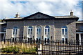
Former St Peter's RC Primary School, Constitution Street, Aberdeen
The central block with 1833 date-stone and motto meaning "for religion and good morals." See: http://www.geograph.org.uk/photo/4123681 for more.
Image: © Bill Harrison
Taken: 16 Aug 2014
0.15 miles
7
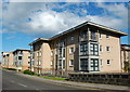
Modern flats, Constitution Street, Aberdeen
The bridge just visible in the right foreground carries the road over the branch line to Waterloo, which is still used for freight traffic.
Image: © Bill Harrison
Taken: 16 Aug 2014
0.15 miles
9
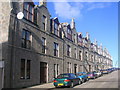
Tenements in Urquhart Street, Aberdeen
Image: © Richard Slessor
Taken: 15 Feb 2006
0.16 miles
10
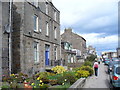
Constitution Street
Interesting mix of granite bungalows and tenements in the east end of Aberdeen. In the distance are modern (non-granite) luxury flats by the beach, built by Stewart Milne.
Image: © Colin Smith
Taken: 9 Apr 2007
0.16 miles