1
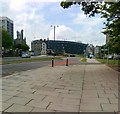
Turf Zone "EagleMay"
Park Street, Aberdeen.
Image: © Ian S
Taken: 4 Oct 2022
0.01 miles
2
The Saltoun Arms, Frederick Street, Aberdeen
A definite survivor, as most of the adjacent granite housing has been cleared to make way for the ring-road. It is presumably named for the Saltoun peerage (se: http://en.wikipedia.org/wiki/Lord_Saltoun ) but the Aberdeen connection is not known.
Image: © Bill Harrison
Taken: 30 Jun 2012
0.03 miles
3
Saltoun Arms, Park Street, Aberdeen
Image: © Ian S
Taken: 4 Oct 2022
0.03 miles
4
Beach Boulevard, Aberdeen (approximate site of Albion Street Congregational Church)
This important link from the inner ring-road to the beach was carved out in the 1960s as part of slum-clearance efforts. So far as I can tell, the famous(?) Albion Street Congregational Church was located somewhere near the traffic island seen here. Supported by Queen Victoria who donated £20, Albion Street pioneered spiritual and moral "outreach" to working class slums in Aberdeen and was built on the site of a notorious "theatre." According to Gammie (The Churches of Aberdeen, publ. 1909 and available on-line): "The district had acquired an unenviable reputation for fostering the lowest forms of vice, and the unchecked ruffianism of its inhabitants was so pronounced that it was regarded as unsafe for any respectable citizen to venture unprotected within its confines." For its history, see Religion and Social Class (the Disruption Years in Aberdeen) by MacLaren. For more, see: http://www.mcjazz.f2s.com/Education.htm .
Image: © Bill Harrison
Taken: 16 Aug 2014
0.03 miles
5
Beach Boulevard, Aberdeen
Image: © Alex McGregor
Taken: 8 Jun 2011
0.03 miles
6
Sheltered housing, Constitution Street, Aberdeen
Seen from Beach Boulevard
Image: © Bill Harrison
Taken: 30 Jun 2012
0.04 miles
7
Park Street, Aberdeen
Image: © Ian S
Taken: 4 Oct 2022
0.05 miles
8
Former Frederick Street School, Aberdeen
This spectacular listed building (see: http://www.britishlistedbuildings.co.uk/sc-50944-frederick-street-frederick-street-busines ) was erected in about 1905. Note the bars enclosing the roof playground (see: http://www.oldchap.f2s.com/aberdeen/LetsSeeSomePictures_Page196.html )
The school has closed and it now accommodates "aspirational" offices for Aberdeen City Council. Next door is/are "Devine Angels," the neighbourhood psychic.
Image: © Bill Harrison
Taken: 30 Jun 2012
0.05 miles
9
A look down Park Street, Aberdeen
Image: © Bill Harrison
Taken: 30 Jun 2012
0.06 miles
10
Frederick Street, Aberdeen
Image: © Alex McGregor
Taken: 8 Jun 2011
0.06 miles


