1
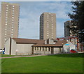
Council flats, Hayton Road, Aberdeen
The Tillydrone estate was built in the 1960s as a mixture of flats, high-rises and houses; see: http://en.wikipedia.org/wiki/Tillydrone
Image: © Bill Harrison
Taken: 23 Feb 2013
0.03 miles
2
Eco-houses, Hayton Road, Aberdeen
These recently replaced some derelict 1960s flats, which had become uninhabitable due to antisocial behaviour.
Image: © Bill Harrison
Taken: 23 Feb 2013
0.03 miles
3
New Eco-houses on Hayton Road
Image: © Bill Harrison
Taken: 23 Feb 2013
0.04 miles
4
Hayton Road, Aberdeen
The main street through the Tillydrone estate.
Image: © Bill Harrison
Taken: 23 Feb 2013
0.04 miles
5
Don Street railway station (site), Aberdeen, 2017
Opened in 1887 on the Great North of Scotland Railway's line from Aberdeen to Keith, this station closed in 1937. The line was later singled.
View south east towards Kittybrewster and Aberdeen. A year after this image was taken, the line was redoubled.
Image: © Nigel Thompson
Taken: 24 May 2017
0.05 miles
6
Council flats, Alexander Terrace, Aberdeen
Recently refurbished; Alexander Terrace is on the other side of the building.
Image: © Bill Harrison
Taken: 23 Feb 2013
0.07 miles
7
Riverbank Primary School, Dill Road, Aberdeen
Now the only primary school in Tillydrone and formerly known as Donbank Primary School.
Image: © Bill Harrison
Taken: 23 Feb 2013
0.11 miles
8
Junction
Don Place on the left, meeting Donbank Terrace.
Image: © Bill Harrison
Taken: 28 Apr 2011
0.12 miles
9
Embassy Building, Woodside
Sadly, alcohol abuse and gambling are serious issues in this area of social deprivation.
Image: © Bill Harrison
Taken: 28 Apr 2011
0.14 miles
10
Aberdeen Lads' Club, Dill Road, Tillydrone
This youth club welcomes boys and girls, despite its name. The tower blocks of (left-to-right) St Machar Court, Grandholm Court and Donside Court loom up in the background...
Image: © Bill Harrison
Taken: 27 Sep 2014
0.14 miles


