
IMAGES TAKEN NEAR TO
Don Terrace, ABERDEEN, AB24 2UH
Introduction
This page details the photographs taken nearby to Don Terrace, AB24 2UH by members of the Geograph project.
The Geograph project started in 2005 with the aim of publishing, organising and preserving representative images for every square kilometre of Great Britain, Ireland and the Isle of Man.

There are currently over 7.5m images from over14,400 individuals and you can help contribute to the project by visiting https://www.geograph.org.uk
Image Map
Images are licensed for reuse under creativecommons.org/licenses/by-sa/2.0
Notes
- Clicking on the map will re-center to the selected point.
- The higher the marker number, the further away the image location is from the centre of the postcode.
Image Listing (81 Images Found)
Images are licensed for reuse under creativecommons.org/licenses/by-sa/2.0
Image
Details
Distance
3
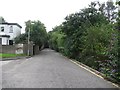
Don Terrace
Note the speed bumps, they are a useful accessory here.
Image: © Richard Webb
Taken: 3 Aug 2011
0.04 miles
4
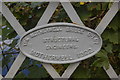
Scottish Made, and Proud of it...
Builder's plate on the bridge over the Don.
Image: © Bill Harrison
Taken: 20 Sep 2009
0.05 miles
5
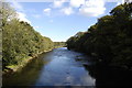
River Don
Flowing serenely as it nears the sea.
Image: © Bill Harrison
Taken: 20 Sep 2009
0.05 miles
6
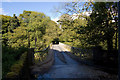
Bridge over the Don
Once an access bridge for a paper mill. For the other end of the bridge, see: http://www.geograph.org.uk/photo/1499795
Image: © Bill Harrison
Taken: 20 Sep 2009
0.05 miles
7
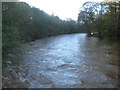
River Don looking West from Grandholm Bridge
River Don looking West from Grandholm Bridge after the rain storms at the beginning of November 09.
Image: © Elaine Cooper
Taken: 2 Nov 2009
0.07 miles
9

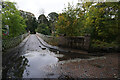
Apartheid, Aberdeen Style
A long-standing transport problem in Aberdeen City is the crossing of the River Don -- there are just two public road bridges. However, some of the paper mills that once lined the Don has their own private crossings. Most of the mills are gone, but the bridges remain. The Don also represents a cultural divide: much of its southern bank is lined with working-class communities such as Woodside, Tillydrone and Seaton, whereas the northern bank is middle-class commuter-land. Here we see one upshot of this tension: bollards that sink into the road to allow certain vehicles to pass but not others: the powers-that-be have granted the middle-class residents of the north bank electronic passes to access a quick route to the city centre but working-class residents of Tillydrone who wish to head north are not so fortunate... It all brings to mind a famous dispute in the 1930s in Oxford: http://www.oxfordmail.co.uk/news/4185278.50th_anniversary_of__snob_walls__demolition/
Image: © Bill Harrison
Taken: 20 Sep 2009
0.09 miles
10
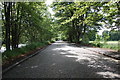
Granite setts
This road, laid with granite setts, possibly served the former Grandholm Mill.
Image: © Bill Harrison
Taken: 12 Jun 2016
0.10 miles