
IMAGES TAKEN NEAR TO
Clarks Lane, ABERDEEN, AB24 1UF
Introduction
This page details the photographs taken nearby to Clarks Lane, AB24 1UF by members of the Geograph project.
The Geograph project started in 2005 with the aim of publishing, organising and preserving representative images for every square kilometre of Great Britain, Ireland and the Isle of Man.

There are currently over 7.5m images from over14,400 individuals and you can help contribute to the project by visiting https://www.geograph.org.uk
Image Map
Images are licensed for reuse under creativecommons.org/licenses/by-sa/2.0
Notes
- Clicking on the map will re-center to the selected point.
- The higher the marker number, the further away the image location is from the centre of the postcode.
Image Listing (277 Images Found)
Images are licensed for reuse under creativecommons.org/licenses/by-sa/2.0
Image
Details
Distance
1
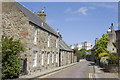
Don Street
Two types of characteristic Aberdeen dwellings: in the foreground a fine granite house, in the background brightly painted tower blocks at Seaton.
Image: © Bill Harrison
Taken: 24 Jun 2008
0.02 miles
2
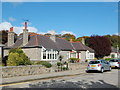
Stretched bungalow
An unusual semi-detached bungalow, twice as big as its neighbours.
Image: © Bill Harrison
Taken: 12 Oct 2013
0.03 miles
3
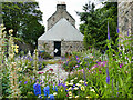
Garden on Don Street, Old Aberdeen
Colourful lupins and other flowers.
Image: © Stephen Craven
Taken: 3 Jul 2019
0.03 miles
4
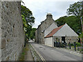
East end of the Chanonry, Old Aberdeen
The street covers three sides of a polygon. The building to the right is category B listed (LB20200) and dates from the 16th and 17th century.
Image: © Stephen Craven
Taken: 3 Jul 2019
0.04 miles
5

20 The Chanonry
This looks like a gateway which has since been built in, with a barred window. Above it is a bishop's mitre, which is interesting because there have been no bishops in the Church of Scotland since 1690, when episcopacy was finally rejected after many decades of struggle and dissent.
Image: © Anne Burgess
Taken: 21 Apr 2026
0.04 miles
6
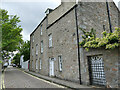
The Dower House, Don Street, Old Aberdeen
An 18th century building, category B listed (LB20282).
Image: © Stephen Craven
Taken: 3 Jul 2019
0.05 miles
7
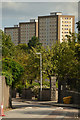
Old Aberdeen and New Aberdeen, Scotland
Dunbar Street, part of an area known as old Aberdeen. In the background can be seen the tower blocks at Seaton, no doubt part of 'new Aberdeen'.
Image: © Andrew Tryon
Taken: 17 Aug 2019
0.06 miles
8
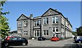
St Peter's RC Primary School
One of three 'faith' primary schools in Aberdeen City. Unlike some other Scottish cities, secondary education is not segregated. For the other side of the school facing onto King Street, see: https://www.geograph.org.uk/photo/3699232 .
Image: © Bill Harrison
Taken: 13 Jun 2023
0.06 miles
9
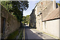
The Chanonry
View towards St Machar Cathedral.
Image: © Bill Harrison
Taken: 7 Sep 2009
0.06 miles
10
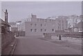
Dunbar Halls of Residence
Looking along Harrow Street towards a small two storey building on Don Street, and with higher blocks behind. Dunbar Halls was one of the University of Aberdeen's halls of residence. The blocks were built in 1969 and received a Civic Trust Award at the time. They were demolished about 2003 and as far as I am aware, the site is still to be redeveloped.
Image: © Richard Sutcliffe
Taken: Unknown
0.06 miles