
IMAGES TAKEN NEAR TO
Manor Drive, ABERDEEN, AB16 7UA
Introduction
This page details the photographs taken nearby to Manor Drive, AB16 7UA by members of the Geograph project.
The Geograph project started in 2005 with the aim of publishing, organising and preserving representative images for every square kilometre of Great Britain, Ireland and the Isle of Man.

There are currently over 7.5m images from over14,400 individuals and you can help contribute to the project by visiting https://www.geograph.org.uk
Image Map
Images are licensed for reuse under creativecommons.org/licenses/by-sa/2.0
Notes
- Clicking on the map will re-center to the selected point.
- The higher the marker number, the further away the image location is from the centre of the postcode.
Image Listing (34 Images Found)
Images are licensed for reuse under creativecommons.org/licenses/by-sa/2.0
Image
Details
Distance
1
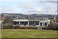
Derelict shops, Logie Place, Aberdeen
Image: © Bill Harrison
Taken: 24 Feb 2013
0.04 miles
2
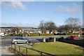
Urban green space
Across the road, the small park bordered by Logie Terrace to the left.
Image: © Bill Harrison
Taken: 24 Feb 2013
0.07 miles
3
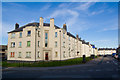
Council Flats...
...on Logie Avenue with Manor Drive in the foreground.
Image: © Bill Harrison
Taken: 19 Sep 2008
0.07 miles
4
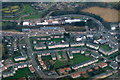
Logie Avenue, Middlefield, Aberdeen, from the air
Taken from a plane just after take-off from Aberdeen Airport,
Image: © Mike Pennington
Taken: 9 Feb 2017
0.08 miles
5
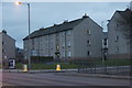
Housing, Auchmill Road, Aberdeen
On the corner of Manor Drive.
Image: © Mike Pennington
Taken: 12 Mar 2010
0.09 miles
6
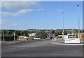
New road junction
Junction with the new link road connecting the A92 and the A96 thereby avoiding the Haudagain roundabout. The road leads to some council flats, which are now completely surrounded by major roads. In the distance can be seen identikit houses in the sprawling suburb of Danestone to the north of the River Don.
Image: © Bill Harrison
Taken: 19 May 2022
0.10 miles
7
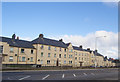
1930s Council block, Manor Avenue, Aberdeen
The twin of the block up the road (see: http://www.geograph.org.uk/photo/3344652 ) but rendered in primrose stucco.
Image: © Bill Harrison
Taken: 24 Feb 2013
0.11 miles
8
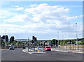
Link road junction
The intermediate traffic-light controlled junction on the new link road connecting the A92 (behind the photographer) with the A96 (junction just visible in the distance).
Image: © Bill Harrison
Taken: 19 May 2022
0.11 miles
9
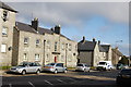
Granite council flats, Manor Avenue, Aberdeen
Close-up of the end of the block seen here: http://www.geograph.org.uk/photo/3344652
Image: © Bill Harrison
Taken: 24 Feb 2013
0.11 miles
10
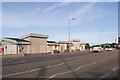
Retail units
Auchmill Road (the A96) in the foreground.
Image: © Bill Harrison
Taken: 19 Sep 2008
0.12 miles