IMAGES TAKEN NEAR TO
Moir Crescent, ABERDEEN, AB16 7BX
Introduction
This page details the photographs taken nearby to Moir Crescent, AB16 7BX by members of the Geograph project.
The Geograph project started in 2005 with the aim of publishing, organising and preserving representative images for every square kilometre of Great Britain, Ireland and the Isle of Man.

There are currently over 7.5m images from over14,400 individuals and you can help contribute to the project by visiting https://www.geograph.org.uk
Image Map
Images are licensed for reuse under creativecommons.org/licenses/by-sa/2.0
Notes
- Clicking on the map will re-center to the selected point.
- The higher the marker number, the further away the image location is from the centre of the postcode.
Image Listing (23 Images Found)
Images are licensed for reuse under creativecommons.org/licenses/by-sa/2.0
Image
Details
Distance
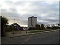
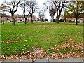
1
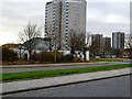
Cummings Park, Aberdeen
This council estate was built in the 1960s, definitely in the post-granite era for Aberdeen.
Image: © Bill Harrison
Taken: 9 Mar 2013
0.07 miles
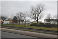
2
Shuttered shops
A small parade of shops on Moir Green. It's hard to say if they're closed for the day or closed for good...
Image: © Bill Harrison
Taken: 13 Jan 2013
0.11 miles
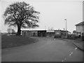
3
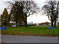
Glimpse of a playpark
As seen from the A90
Image: © Bill Harrison
Taken: 15 Apr 2011
0.12 miles
6
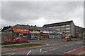
Rosehill Shops
From left to right: Chinese take-away, convenience store, chipper (fish and chip shop), bank.
Image: © Bill Harrison
Taken: 9 Mar 2013
0.19 miles
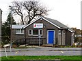
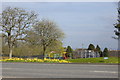
9
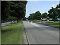
Provost Rust Drive
Heading south east towards the A90.
Image: © JThomas
Taken: 18 Jul 2014
0.20 miles