IMAGES TAKEN NEAR TO
Bieldside, ABERDEEN, AB15 9BT
Introduction
This page details the photographs taken nearby to AB15 9BT by members of the Geograph project.
The Geograph project started in 2005 with the aim of publishing, organising and preserving representative images for every square kilometre of Great Britain, Ireland and the Isle of Man.

There are currently over 7.5m images from over14,400 individuals and you can help contribute to the project by visiting https://www.geograph.org.uk
Image Map
Images are licensed for reuse under creativecommons.org/licenses/by-sa/2.0
Notes
- Clicking on the map will re-center to the selected point.
- The higher the marker number, the further away the image location is from the centre of the postcode.
Image Listing (10 Images Found)
Images are licensed for reuse under creativecommons.org/licenses/by-sa/2.0
Image
Details
Distance
1
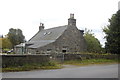
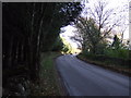
East Lodge, Countesswells
Road junction near Countesswells House.
Image: © Stanley Howe
Taken: 29 Apr 2010
0.02 miles
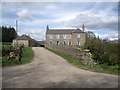
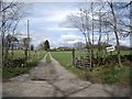
4
Minor road heading east
Near Mains of Countesswells.
Image: © JThomas
Taken: 8 Nov 2013
0.12 miles
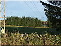
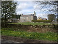
8
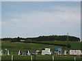
Loanhead equestrian centre
Popular equestrian centre on the edge of the city, riding events are regularly held here. On the flight path to Aberdeen airport at Dyce.
Image: © Lizzie
Taken: 14 May 2005
0.17 miles
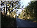
9
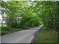
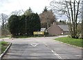
Countesswells Road
A popular route into Aberdeen from the west - well used in the morning and evening rush hour.
Image: © Lizzie
Taken: 3 Jun 2005
0.17 miles