IMAGES TAKEN NEAR TO
Derbeth Grange, ABERDEEN, AB15 8TW
Introduction
This page details the photographs taken nearby to Derbeth Grange, AB15 8TW by members of the Geograph project.
The Geograph project started in 2005 with the aim of publishing, organising and preserving representative images for every square kilometre of Great Britain, Ireland and the Isle of Man.

There are currently over 7.5m images from over14,400 individuals and you can help contribute to the project by visiting https://www.geograph.org.uk
Image Map
Images are licensed for reuse under creativecommons.org/licenses/by-sa/2.0
Notes
- Clicking on the map will re-center to the selected point.
- The higher the marker number, the further away the image location is from the centre of the postcode.
Image Listing (13 Images Found)
Images are licensed for reuse under creativecommons.org/licenses/by-sa/2.0
Image
Details
Distance
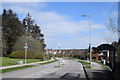
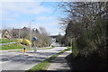
1
Kingswells Crescent...
...with an eerie lack of traffic due to the coronavirus crisis (April, 2020).
Image: © Bill Harrison
Taken: 18 Apr 2020
0.06 miles
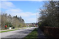
3
Deserted Kingswells...
...during the coronavirus crisis (April, 2020).
Image: © Bill Harrison
Taken: 18 Apr 2020
0.09 miles
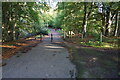
4
Turf Zone "BucksBurn"
Track leading to Corse Wynd, Kingswells.
Image: © Ian S
Taken: 6 Oct 2022
0.17 miles
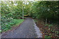
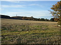
5
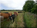
Kingswells up to Brimmond Hill Country Park
Part of Core Path 42 near Derbeth Grange leading towards Webster Park.
Image: © andrew
Taken: 30 Jul 2012
0.18 miles
6
Track at Den of Moss Side
Off Kings Crescent, Kingswells.
Image: © Ian S
Taken: 6 Oct 2022
0.20 miles
7
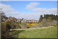
Kingswells view
Houses beyond the valley of the Bucks Burn.
Image: © Bill Harrison
Taken: 18 Apr 2020
0.20 miles
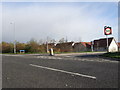
8
Deserted Kingswells Crescent...
...looking towards the bridge over Bucks Burn during the coronavirus crisis (April, 2020).
Image: © Bill Harrison
Taken: 18 Apr 2020
0.23 miles
10
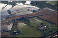
The new Aberdeen bypass at Derbeth, Kingswells, from the air
Taken from plane on the approach to Aberdeen Airport.
Image: © Mike Pennington
Taken: 24 Feb 2017
0.24 miles