IMAGES TAKEN NEAR TO
Kingswells, ABERDEEN, AB15 8PT
Introduction
This page details the photographs taken nearby to AB15 8PT by members of the Geograph project.
The Geograph project started in 2005 with the aim of publishing, organising and preserving representative images for every square kilometre of Great Britain, Ireland and the Isle of Man.

There are currently over 7.5m images from over14,400 individuals and you can help contribute to the project by visiting https://www.geograph.org.uk
Image Map
Images are licensed for reuse under creativecommons.org/licenses/by-sa/2.0
Notes
- Clicking on the map will re-center to the selected point.
- The higher the marker number, the further away the image location is from the centre of the postcode.
Image Listing (14 Images Found)
Images are licensed for reuse under creativecommons.org/licenses/by-sa/2.0
Image
Details
Distance
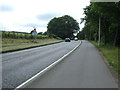
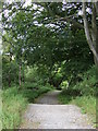
2
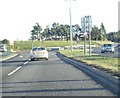
Roundabout on A944 approaching Hazlehead
Main road now bears left to enter Aberdeen via the Lang Stracht.
Image: © Stanley Howe
Taken: 27 Nov 2008
0.17 miles
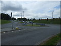
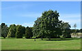
4
Skene Road and the Lang Stracht Junction
Image: © Ralph Greig
Taken: 10 Jul 2023
0.19 miles
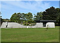
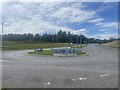
10
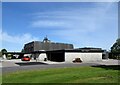
West Chapel, Aberdeen Crematorium
Photo taken at an open-day with permission.
Image: © Bill Harrison
Taken: 2 Sep 2023
0.24 miles