IMAGES TAKEN NEAR TO
Hazledene Drive, ABERDEEN, AB15 8AU
Introduction
This page details the photographs taken nearby to Hazledene Drive, AB15 8AU by members of the Geograph project.
The Geograph project started in 2005 with the aim of publishing, organising and preserving representative images for every square kilometre of Great Britain, Ireland and the Isle of Man.

There are currently over 7.5m images from over14,400 individuals and you can help contribute to the project by visiting https://www.geograph.org.uk
Image Map
Images are licensed for reuse under creativecommons.org/licenses/by-sa/2.0
Notes
- Clicking on the map will re-center to the selected point.
- The higher the marker number, the further away the image location is from the centre of the postcode.
Image Listing (9 Images Found)
Images are licensed for reuse under creativecommons.org/licenses/by-sa/2.0
Image
Details
Distance
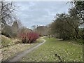
2
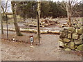
Linking footpath
Joint venture between Aberdeen Greenspace and the City Council.
Image: © Ewen Rennie
Taken: 4 Apr 2010
0.10 miles
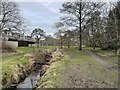
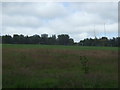
4
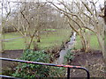
Stream and path
Link between Craigiebuckler and Hazlehead
Image: © Ewen Rennie
Taken: 4 Apr 2010
0.13 miles
5
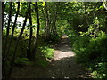
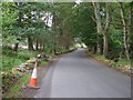
Track from Hazelhead to Countesswells
The track runs along the edge of the wood, between Den Wood and Hazelhead Park near the playing fields. This picture looks along it heading south, away from Hazledene Road.
Image: © Alec MacKinnon
Taken: 31 May 2014
0.15 miles
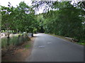
6
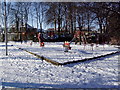
Craigiebuckler children's playground
Just off the terminus for the No. 16 bus is a small football pitch and children's playground; one of seven I visited in eighty minutes whilst walking the dog.
Image: © Ewen Rennie
Taken: 21 Feb 2010
0.15 miles