
IMAGES TAKEN NEAR TO
Thorngrove Place, ABERDEEN, AB15 7FJ
Introduction
This page details the photographs taken nearby to Thorngrove Place, AB15 7FJ by members of the Geograph project.
The Geograph project started in 2005 with the aim of publishing, organising and preserving representative images for every square kilometre of Great Britain, Ireland and the Isle of Man.

There are currently over 7.5m images from over14,400 individuals and you can help contribute to the project by visiting https://www.geograph.org.uk
Image Map
Images are licensed for reuse under creativecommons.org/licenses/by-sa/2.0
Notes
- Clicking on the map will re-center to the selected point.
- The higher the marker number, the further away the image location is from the centre of the postcode.
Image Listing (31 Images Found)
Images are licensed for reuse under creativecommons.org/licenses/by-sa/2.0
Image
Details
Distance
1
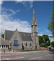
Mannofield Kirk
Built 1882 and still active.
Image: © Bill Harrison
Taken: 2 Jun 2013
0.09 miles
2
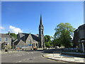
Mannofield Church
Mannofield Church and its tall spire from the junction with Cranford Road to the south.
Image: © Scott Cormie
Taken: 21 May 2022
0.09 miles
5
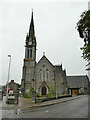
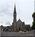
Mannofield Parish Church, Aberdeen
Built in 1882, architects Jenkins and Marr, listed category C (LB51979) as "a prominent and well-detailed example of Scottish church architecture at the peak of church construction in the second half of the 19th century." See Image for a view from a different angle.
Image: © Stephen Craven
Taken: 4 Jul 2019
0.10 miles
6
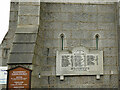
War memorial on Mannofield Parish Church, Aberdeen
The World War 1 memorial is on the outside wall of the church near the entrance.
Image: © Stephen Craven
Taken: 4 Jul 2019
0.10 miles
7
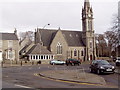
Mannofield Church
The church hall is in the foreground
Image: © Ewen Rennie
Taken: 6 Mar 2010
0.11 miles
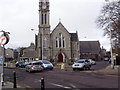
10
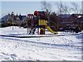
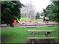
Thorngrove kiddies play area
This is one of seven children's playgrounds in the West End of Aberdeen that I visited in the course of an eighty minute dog walk. A sign nearby says that it and surrounding landscaped area is maintained by residents of the mini-estate which was built on the former site of the RGU school playing fields.
The seven are Rubislaw, Kepplestone, Johnston Gardens, Craigiebuckler, Airyhall, Craigielea and Thorngrove.
Image: © Ewen Rennie
Taken: 21 Feb 2010
0.11 miles