1
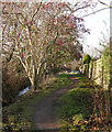
Rubislaw Park
From near Springfield Avenue.
Image: © Stanley Howe
Taken: 10 Jun 2010
0.07 miles
2
Rubislaw Quarry with Conoco-Phillips behind
Image: © Ewen Rennie
Taken: 5 Jun 2010
0.10 miles
3
Rubislaw Quarry with Chevron Offices behind
Image: © Ewen Rennie
Taken: 5 Jun 2010
0.13 miles
4
Den Burn
A small stream running along the back of houses. It passes through this wooded area.
There is a path alongside the burn, with several bridges across.
Image: © Craig Wallace
Taken: 19 Jan 2020
0.14 miles
5
Rubislaw Quarry
A very deep hole and source of most of Aberdeen's granite. Since closure in 1971 it has filled with water and is 150m deep. It was sold in 2010.
Rubislaw Quarry is notoriously hard to view, and I got here by accident. Stopping to read my map on Queen's Road, I noticed a fence and "danger" signs. Suspecting I was by the famous quarry, I popped up the bank to the fence. In Summer it would probably be hard to see much from here.
Image: © Richard Webb
Taken: 20 Dec 2011
0.15 miles
6
Rubislaw Quarry from East
The gated community at top of Queens Avenue is usually open so can view through fence
Image: © Ewen Rennie
Taken: 5 Jun 2010
0.16 miles
7
Rubislaw Quarry, Aberdeen
The quarry that supplied most of the granite used in the houses of Aberdeen. It closed in 1971 and was said to be the largest man-made hole in Europe. As can be seen, it has since filled with water. The only public viewpoint is through a fence on the Queen's Road side. The buildings seen are oil company offices built in the 1980s.
Image: © Richard Slessor
Taken: 22 Jun 2004
0.16 miles
8
Rubislaw Quarry, Aberdeen, from the air
Apparently, an estimated six million tonnes of granite was extracted from this hole, and much of Aberdeen was built with it.
Image: © Mike Pennington
Taken: 22 Oct 2013
0.17 miles
9
Path by the Den Burn
The path runs alongside the burn, behind the houses. Heading towards Westholme Avenue.
A mixture of trees beside the burn, some laden with red berries.
Image: © Craig Wallace
Taken: 19 Jan 2020
0.17 miles
10
Carnegie Crescent, Aberdeen
Approx grid reference NJ912059.
Image: © Richard Slessor
Taken: 21 Mar 2006
0.18 miles


