IMAGES TAKEN NEAR TO
Westholme Crescent North, ABERDEEN, AB15 6AE

Introduction

This page details the photographs taken nearby to Westholme Crescent North, AB15 6AE by members of the Geograph project.

The Geograph project started in 2005 with the aim of publishing, organising and preserving representative images for every square kilometre of Great Britain, Ireland and the Isle of Man.

There are currently over 7.5m images from over14,400 individuals and you can help contribute to the project by visiting https://www.geograph.org.uk

Image Map


Images are licensed for reuse under creativecommons.org/licenses/by-sa/2.0
Notes
  • Clicking on the map will re-center to the selected point.
  • The higher the marker number, the further away the image location is from the centre of the postcode.

Image Listing (23 Images Found)

Images are licensed for reuse under creativecommons.org/licenses/by-sa/2.0
  • ...
Image
Details
Distance
1
Westholme Crescent (1978)
With the North Burn of Rubislaw running through between Northburn Avenue and Westholme Crescent.
Image: © Stanley Howe Taken: Unknown
0.01 miles
2
Westholme Crescent
Den Burn in the foreground.
Image: © Stanley Howe Taken: 28 May 2009
0.04 miles
3
Junction of Westholme Terrace with Springfield Road
Image: © Stanley Howe Taken: 28 May 2009
0.10 miles
4
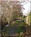
Path by the Den Burn
The path runs alongside the burn, behind the houses. Heading towards Westholme Avenue. A mixture of trees beside the burn, some laden with red berries.
Image: © Craig Wallace Taken: 19 Jan 2020
0.10 miles
5
New house, Springfield Road
Image: © Alex McGregor Taken: 20 Nov 2014
0.10 miles
6
Cherry Blossom Trees in Westholme Avenue
Image: © Richard Slessor Taken: 13 May 2005
0.12 miles
7
Queen's Road traffic lights
At junction with Springfield Road, Hazlehead, Aberdeen.
Image: © Stanley Howe Taken: 30 May 2015
0.13 miles
8
Old Milestone by the B9119, Queen's Road
Aberdeen granite by the B9119, in parish of Aberdeen (Aberdeen City), junction with Hazelhead Road, in acute corner. Surveyed Milestone Society National ID: CA_ADAL02.
Image: © Milestone Society Taken: Unknown
0.13 miles
9
Traffic island
Image: © Alex McGregor Taken: 20 Nov 2014
0.14 miles
10
Den Burn
A small stream running along the back of houses. It passes through this wooded area. There is a path alongside the burn, with several bridges across.
Image: © Craig Wallace Taken: 19 Jan 2020
0.15 miles
  • ...