1
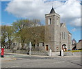
Church and Shop on Midstocket Road
Image: © Richard Slessor
Taken: 7 Sep 2006
0.03 miles
2
Midstocket Road, Aberdeen
This road runs for about a mile from Mile End to North Anderson Drive. Most of the housing in the vicinity dates from the early 20th Century.
Image: © Richard Slessor
Taken: 12 Jun 2006
0.03 miles
3
Midstocket Kirk
Church of Scotland: this forward-looking church has its own website: http://www.midstocketchurch.org.uk/. Harcourt Road heads off to the left; in the foreground Mid Stocket Road. The church, built in 1900, is dedicated to St Ninian and B-listed: http://www.britishlistedbuildings.co.uk/sc-19971-mid-stocket-road-st-ninian-s-church-churc .
Image: © Bill Harrison
Taken: 12 Apr 2011
0.06 miles
4
Mid Stocket Road, Aberdeen
The spire of Beechgrove Church is visible in the distance.
Image: © Bill Harrison
Taken: 12 Apr 2011
0.08 miles
5
Looking down Harcourt Road
Major construction work at Forresterhill hospital complex in the distance.
Image: © Bill Harrison
Taken: 12 Apr 2011
0.08 miles
6
Granite Terrace, Mid Stocket Road
Utterly typical housing in the "West End" of Aberdeen.
Image: © Bill Harrison
Taken: 12 Apr 2011
0.08 miles
7
Looking down Camperdown Road, Aberdeen
Image: © Bill Harrison
Taken: 12 Apr 2011
0.11 miles
8
View up Mid Stocket Road, Aberdeen
The disused hulk of Beechgrove Church is prominent on the left-hand side of the street.
Image: © Bill Harrison
Taken: 26 Feb 2012
0.14 miles
9
The Atholl Hotel, 54 King's Gate, Aberdeen
This B-listed building (see: http://www.britishlistedbuildings.co.uk/sc-20413-54-king-s-gate-atholl-hotel-including-gat ) is thought to have begun life as a Scottish Baronial-style house. The east extension with its delicate granite-work tracery and pinnacles is said to have been a "dry run" for the façade of Marischal College.
Image: © Bill Harrison
Taken: 16 Mar 2014
0.15 miles
10
On the curve (Oakhill Road, Aberdeen)
Typical 1930s semi-detached granite villas.
Image: © Bill Harrison
Taken: 5 Jan 2013
0.16 miles


