IMAGES TAKEN NEAR TO
Brighton Grange, PETERCULTER, AB14 0UF

Introduction

This page details the photographs taken nearby to Brighton Grange, AB14 0UF by members of the Geograph project.

The Geograph project started in 2005 with the aim of publishing, organising and preserving representative images for every square kilometre of Great Britain, Ireland and the Isle of Man.

There are currently over 7.5m images from over14,400 individuals and you can help contribute to the project by visiting https://www.geograph.org.uk

Image Map


Images are licensed for reuse under creativecommons.org/licenses/by-sa/2.0
Notes
  • Clicking on the map will re-center to the selected point.
  • The higher the marker number, the further away the image location is from the centre of the postcode.

Image Listing (72 Images Found)

Images are licensed for reuse under creativecommons.org/licenses/by-sa/2.0
  • ...
Image
Details
Distance
1
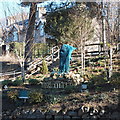
Peterculter village sign
A clever sculpture of St Peter (can you see it?).
Image: © Bill Harrison Taken: 28 Feb 2016
0.06 miles
2
Peterculter Sculpture
Situated on the western approach to Peterculter, erected on July 2013. The sculpture represents St Peter after whom the parish is named.
Image: © Alan Findlay Taken: 31 Jul 2013
0.07 miles
3
Peterculter Sculpture
Situated on the western approach to Peterculter, erected on July 2013. The sculpture represents St Peter after whom the parish is named.
Image: © Alan Findlay Taken: 3 Aug 2013
0.07 miles
4
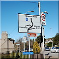
The Peterculter wonky sign
This road sign on the A93 makes a special effort to accurately show the curvature of the roads at and beyond the junction.
Image: © Bill Harrison Taken: 28 Feb 2016
0.07 miles
5
Peterculter Sculpture
Peterculter Sculpture, erected July 2013, at the western approach to the village. The sculpture represents St Peter after whom the parish is named.
Image: © Alan Findlay Taken: 16 Aug 2013
0.08 miles
6
North Deeside Road
The main road through Peterculter, seen from the junction with Station Road West. Blacks Bar is on the corner.
Image: © Stephen Craven Taken: 2 Jul 2019
0.09 miles
7
Peterculter road bridge over Culter Burn
Upstream face.
Image: © Stanley Howe Taken: 22 Apr 2010
0.09 miles
8
Water pipe across the Culter Burn
The pipe and bridge cross the gorge and Culter Burn, the bridge carries the A93 and has been recently reinforced, the pipe is the mains water pipe to Aberdeen.
Image: © Alan Findlay Taken: 30 Dec 2007
0.09 miles
9
Upstream Culter Burn
From Peterculter road bridge, to the sluice.
Image: © Stanley Howe Taken: 22 Apr 2010
0.09 miles
10
Colourful effigy of Gilderoy
By the Culter Burn in Peterculter.
Image: © Stanley Howe Taken: 22 Apr 2010
0.09 miles
  • ...