IMAGES TAKEN NEAR TO
PETERCULTER, AB14 0PB
Introduction
This page details the photographs taken nearby to AB14 0PB by members of the Geograph project.
The Geograph project started in 2005 with the aim of publishing, organising and preserving representative images for every square kilometre of Great Britain, Ireland and the Isle of Man.

There are currently over 7.5m images from over14,400 individuals and you can help contribute to the project by visiting https://www.geograph.org.uk
Image Map
Images are licensed for reuse under creativecommons.org/licenses/by-sa/2.0
Notes
- Clicking on the map will re-center to the selected point.
- The higher the marker number, the further away the image location is from the centre of the postcode.
Image Listing (11 Images Found)
Images are licensed for reuse under creativecommons.org/licenses/by-sa/2.0
Image
Details
Distance
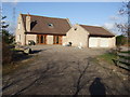
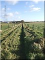
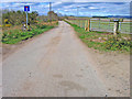
2
West Lasts
Road leading to West Lasts farm.
Image: © Alan Findlay
Taken: 11 Apr 2007
0.08 miles
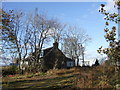
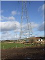
4
Power lines crossing in the middle distance
By The Old Farmhouse, West Lasts.
Image: © Stanley Howe
Taken: 8 Nov 2007
0.11 miles
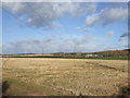
6
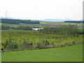
Silver Dam
View from road by Wester Ord, landscape of mixed woodland and rough grazing with small lake.
Image: © Lizzie
Taken: 14 May 2005
0.13 miles
8
North Lasts.
Road leading to North Lasts quarry.
Image: © Alan Findlay
Taken: 11 Apr 2007
0.21 miles
9
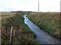
Upstream Ord Burn
From the bridge near Denwell Cottage.
Image: © Stanley Howe
Taken: 8 Nov 2007
0.24 miles
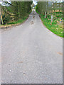
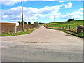
10
North Linn
Road leading to North Linn farm.
Image: © Alan Findlay
Taken: 11 Apr 2007
0.25 miles