IMAGES TAKEN NEAR TO
PETERCULTER, AB14 0LT
Introduction
This page details the photographs taken nearby to AB14 0LT by members of the Geograph project.
The Geograph project started in 2005 with the aim of publishing, organising and preserving representative images for every square kilometre of Great Britain, Ireland and the Isle of Man.

There are currently over 7.5m images from over14,400 individuals and you can help contribute to the project by visiting https://www.geograph.org.uk
Image Map
Images are licensed for reuse under creativecommons.org/licenses/by-sa/2.0
Notes
- Clicking on the map will re-center to the selected point.
- The higher the marker number, the further away the image location is from the centre of the postcode.
Image Listing (10 Images Found)
Images are licensed for reuse under creativecommons.org/licenses/by-sa/2.0
Image
Details
Distance
5
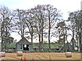
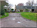
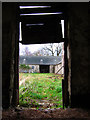
Hilton Farm, Coalford
Disused farm, see Grid Ref NO8298
Image: © Alan Findlay
Taken: 15 Nov 2007
0.14 miles
7
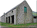
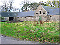
Track to Hilton Farm Cottage
The farm on the opposite side of the valley is West Tilbouries, the river Dee lies below the trees, see Grid Ref NO8298
Image: © Alan Findlay
Taken: 15 Nov 2007
0.16 miles
9
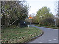
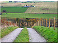
Deeside Way sign
Deeside Way sign on the road junction at Coalford.
Image: © Scott Cormie
Taken: 26 Oct 2019
0.23 miles
10
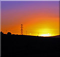
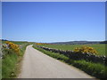
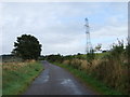
Power lines and pylon on the skyline at sunset
Taken from the Coalford road
Image: © Alan Findlay
Taken: 10 Dec 2007
0.25 miles