
IMAGES TAKEN NEAR TO
Caiesdykes Road, ABERDEEN, AB12 5JU
Introduction
This page details the photographs taken nearby to Caiesdykes Road, AB12 5JU by members of the Geograph project.
The Geograph project started in 2005 with the aim of publishing, organising and preserving representative images for every square kilometre of Great Britain, Ireland and the Isle of Man.

There are currently over 7.5m images from over14,400 individuals and you can help contribute to the project by visiting https://www.geograph.org.uk
Image Map
Images are licensed for reuse under creativecommons.org/licenses/by-sa/2.0
Notes
- Clicking on the map will re-center to the selected point.
- The higher the marker number, the further away the image location is from the centre of the postcode.
Image Listing (24 Images Found)
Images are licensed for reuse under creativecommons.org/licenses/by-sa/2.0
Image
Details
Distance
1
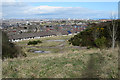
Quarry Entrance
The area with partial concrete cover was the main access to Stoneyhill Quarries, and the route out for quarry products. It is now on the edge of the extensive Kincorth housing estate.
Image: © Anne Burgess
Taken: 20 Mar 2020
0.07 miles
2
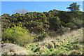
Quarry Face
Lurking beneath the overhanging whins are a few square metres of exposure of a vertical face of pinkish granite that must be a relic of quarrying activity.
Image: © Anne Burgess
Taken: 20 Mar 2020
0.07 miles
3
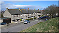
Slessor Drive
The street at the foot of Kincorth Hill.
Image: © Anne Burgess
Taken: 20 Mar 2020
0.07 miles
4
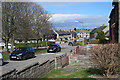
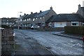
Laws Road
A wide street with a green strip up the middle.
Image: © Anne Burgess
Taken: 20 Mar 2020
0.11 miles
6
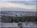
Snow Covered Roof Tops of Aberdeen
This wintry view of Aberdeen was taken from Kincorth Hill.
Image: © Richard Slessor
Taken: 29 Dec 2005
0.12 miles
7
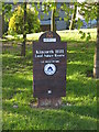
Kincorth Hill
Nature reserve on Kincorth Hill, Aberdeen
Image: © Lizzie
Taken: 21 May 2005
0.14 miles
8
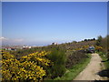
Kincorth Hill Nature Reserve
Picture taken near the disused quarries at NJ936025
Image: © Richard Slessor
Taken: 26 Apr 2004
0.14 miles
9
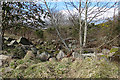
Stoneyhill Quarry (2)
Having braved the hidden blocks in Image] and reached the edge of the hollow, it's now pretty obvious that this was a quarry, with all the abandoned blocks still lying where they have been dumped.
Image: © Anne Burgess
Taken: 20 Mar 2020
0.15 miles
10
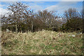
Stoneyhill Quarry (1)
The maps suggests that this is inside one of the old quarries, but there's little evidence of this until you try to walk across the grass and realise that it is full of angular hewn blocks just waiting to trip you up.
Image: © Anne Burgess
Taken: 20 Mar 2020
0.16 miles