IMAGES TAKEN NEAR TO
Earns Heugh Circle, ABERDEEN, AB12 3PY
Introduction
This page details the photographs taken nearby to Earns Heugh Circle, AB12 3PY by members of the Geograph project.
The Geograph project started in 2005 with the aim of publishing, organising and preserving representative images for every square kilometre of Great Britain, Ireland and the Isle of Man.

There are currently over 7.5m images from over14,400 individuals and you can help contribute to the project by visiting https://www.geograph.org.uk
Image Map
Images are licensed for reuse under creativecommons.org/licenses/by-sa/2.0
Notes
- Clicking on the map will re-center to the selected point.
- The higher the marker number, the further away the image location is from the centre of the postcode.
Image Listing (16 Images Found)
Images are licensed for reuse under creativecommons.org/licenses/by-sa/2.0
Image
Details
Distance
1
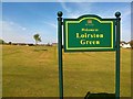
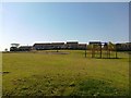
Earn's Heugh View
The name, applied to half a dozen streets in this area, is that of a cove and adjacent cliff near Findon, a couple of miles south of here.
Image: © Anne Burgess
Taken: 20 Mar 2020
0.07 miles
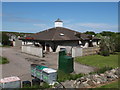
2
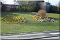
Floral Displays
The bed on the right is supported by EIS Waste for Cove in Bloom.
Image: © Anne Burgess
Taken: 20 Mar 2020
0.10 miles
7
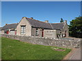
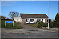
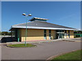
Loirston Community Hall
Possibly the old school, with 1865 on the date-stone.
Image: © Bill Harrison
Taken: 16 Jun 2013
0.18 miles
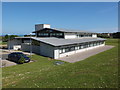
10
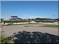
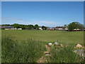
Cove Bay community facilities
The library to the left and Loirston Primary School to the right.
Image: © Bill Harrison
Taken: 16 Jun 2013
0.20 miles