
IMAGES TAKEN NEAR TO
Farquhar Road, ABERDEEN, AB11 8SQ
Introduction
This page details the photographs taken nearby to Farquhar Road, AB11 8SQ by members of the Geograph project.
The Geograph project started in 2005 with the aim of publishing, organising and preserving representative images for every square kilometre of Great Britain, Ireland and the Isle of Man.

There are currently over 7.5m images from over14,400 individuals and you can help contribute to the project by visiting https://www.geograph.org.uk
Image Map
Images are licensed for reuse under creativecommons.org/licenses/by-sa/2.0
Notes
- Clicking on the map will re-center to the selected point.
- The higher the marker number, the further away the image location is from the centre of the postcode.
Image Listing (9 Images Found)
Images are licensed for reuse under creativecommons.org/licenses/by-sa/2.0
Image
Details
Distance
2
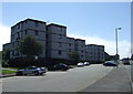
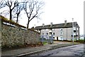
Housing at Balnagask
Mixture of flats and different housing types at Balnagask, Aberdeen
Image: © Lizzie
Taken: 30 Jul 2004
0.12 miles
6
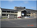
F.R.S. Torry Research Lab
The Fisheries Research Service, Torry Research Laboratory. Picture taken from Victoria Road
Image: © George Wilson
Taken: 19 Aug 2006
0.22 miles
7
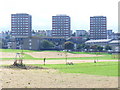
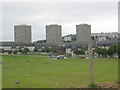
Balnagask Housing Estate
1960s development of low and high rise houses in south-eastern Aberdeen. In the foreground is the park by the ruined St Fittick's Church.
Image: © Colin Smith
Taken: 10 Aug 2009
0.22 miles
8
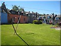
Old cottages in Torry
The best preserved of the few squares of fishermen's cottages still remaining in Torry. Much of the old fishing village was torn down to make way for new port installations during the oil boom.
Image: © Oliver Dixon
Taken: 25 May 2008
0.22 miles
9
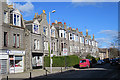
Victoria Road
This is the main street in 'New Torry', the expansion of which began with the construction of the Victoria Bridge in 1881. Victoria Street and the adjacent streets are lined with silver-grey granite tenements and villas.
Image: © Anne Burgess
Taken: 9 Mar 2018
0.25 miles