
IMAGES TAKEN NEAR TO
South Grampian Circle, ABERDEEN, AB11 8HH
Introduction
This page details the photographs taken nearby to South Grampian Circle, AB11 8HH by members of the Geograph project.
The Geograph project started in 2005 with the aim of publishing, organising and preserving representative images for every square kilometre of Great Britain, Ireland and the Isle of Man.

There are currently over 7.5m images from over14,400 individuals and you can help contribute to the project by visiting https://www.geograph.org.uk
Image Map
Images are licensed for reuse under creativecommons.org/licenses/by-sa/2.0
Notes
- Clicking on the map will re-center to the selected point.
- The higher the marker number, the further away the image location is from the centre of the postcode.
Image Listing (30 Images Found)
Images are licensed for reuse under creativecommons.org/licenses/by-sa/2.0
Image
Details
Distance
1
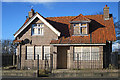
Boarded-up House
This looks as if it is in the grounds of Tullos Academy. One would have thought that it would be easy to find tenants or a buyer for a house like this.
Image: © Anne Burgess
Taken: 9 Mar 2018
0.05 miles
2
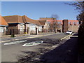
Torry Academy
The original school building on the left with the 1970's addition on the right with the funny roof.
Image: © Ewen Rennie
Taken: 2 Apr 2010
0.05 miles
3
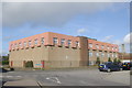
Torry Academy
The austere, even grim facade of this secondary school.
Image: © Bill Harrison
Taken: 24 Sep 2011
0.05 miles
4
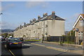
Granite terrace, Grampian Place, Torry
Image: © Bill Harrison
Taken: 24 Sep 2011
0.07 miles
5
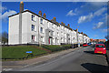
Grampian Place
Neat 20th century council housing with unusually decent-sized windows. It's amazing how effective a row of wheelie bins can be in spoiling the appearance of a street.
Image: © Anne Burgess
Taken: 9 Mar 2018
0.09 miles
6
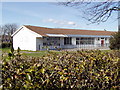
The old Torry Nursery School
Note the overhanging roof and the big glass doors from the fresh air tradition of the thirties and forties.
Image: © Ewen Rennie
Taken: 2 Apr 2010
0.12 miles
7
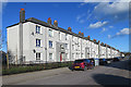
Tullos Place
Neat 20th century council housing with unusually decent-sized windows. It's amazing how effective a couple of large wheeled bins can be in spoiling the appearance of a street.
Image: © Anne Burgess
Taken: 9 Mar 2018
0.13 miles
8
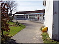
The old Torry Nursery School on Oscar Road
Closed about two years ago and currently used by the after school club but surely phased for demolition.
Image: © Ewen Rennie
Taken: 2 Apr 2010
0.13 miles
9
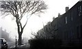
Early morning sea haar in Torry housing estate.
On the east coast of Scotland a sea fog, known locally as Haar, often plagues the local residents and ruins what would otherwise be a fine day. It most commonly occurs between April and September, on or near the east coast or in the Northern Isles.
It does not usually penetrate far inland, but can filter through valleys like the Great Glen and the Central Lowlands as far as Glasgow. Haar forms when a parcel of warm air passes over the cold North Sea. The warm air at the bottom of the parcel is cooled by the cold air below, until it can no longer 'hold' the moisture that was previously contained within. Therefore, it releases some of the moisture in the form of liquid water through condensation. Add an onshore component like a wind of 5-20mph, and the cooling in the bottom of the warm parcel of air is spread upwards and generates a fog like Haar.
Image: © Colin Kinnear
Taken: 3 Feb 2011
0.14 miles
10
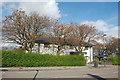
Torry Neighbourhood Centre, Oscar Road, Torry
Torry has been blighted by substance abuse more than most communities and this "one stop shop" (see: http://www.aberdeencity.gov.uk/xcc_NeighbourhoodDetail.asp?id=2593&ind=4&ind2=47&cat=2) is one response from the City of Aberdeen.
Image: © Bill Harrison
Taken: 24 Sep 2011
0.15 miles