
IMAGES TAKEN NEAR TO
Bon Accord Street, ABERDEEN, AB11 6UY
Introduction
This page details the photographs taken nearby to Bon Accord Street, AB11 6UY by members of the Geograph project.
The Geograph project started in 2005 with the aim of publishing, organising and preserving representative images for every square kilometre of Great Britain, Ireland and the Isle of Man.

There are currently over 7.5m images from over14,400 individuals and you can help contribute to the project by visiting https://www.geograph.org.uk
Image Map
Images are licensed for reuse under creativecommons.org/licenses/by-sa/2.0
Notes
- Clicking on the map will re-center to the selected point.
- The higher the marker number, the further away the image location is from the centre of the postcode.
Image Listing (153 Images Found)
Images are licensed for reuse under creativecommons.org/licenses/by-sa/2.0
Image
Details
Distance
1
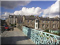
Bridge over Rosebank Terrace, Ferryhill
The bridge forms part of Bon Accord Street. The photo looks towards Aberdeen City Centre where the spire of Langstane Kirk can be seen.
Image: © Richard Slessor
Taken: 21 Aug 2004
0.02 miles
2
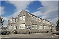
Ferryhill Primary School
Yet another of Aberdeen's massive three-storey granite primary schools from the early 20th Century (see: http://www.geograph.org.uk/photo/3066721 ).
Image: © Bill Harrison
Taken: 1 Sep 2012
0.05 miles
3
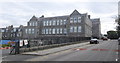
Ferryhill Primary School, Caledonian Place, Aberdeen
Yet another of the massive, three-storey granite primary schools built in Aberdeen just over 100 years ago.
Image: © Bill Harrison
Taken: 1 Sep 2012
0.05 miles
4
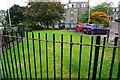
Turf Zone "Rosebank"
On Rosebank Gardens, Aberdeen.
Image: © Ian S
Taken: 5 Oct 2022
0.05 miles
5
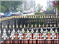
Springbank Terrace
Ornate railings line the pathways leading from the street to the terraced houses in this Aberdeen street. Below the pathways are "the sunks", the basement rooms / flats.
Image: © Colin Smith
Taken: 2 Aug 2011
0.05 miles
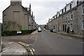
7
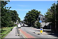
Looking along Willowbank Road (the A93)
The A93, which extends some 177 km from Aberdeen to Perth via Braemar, is one of the most scenic roads in the UK according to the SABRE roads web site: https://www.sabre-roads.org.uk/wiki/index.php?title=A93 .
Image: © Bill Harrison
Taken: 12 Jul 2020
0.06 miles
8
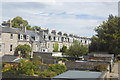
Rosebank Terrace seen from Bon Accord Street bridge
Bon Accord Street crosses over Rosebank Terrace on a bridge. Rosebank Terrace used to serve as the "tradesmen's entrances" to the houses fronting onto Springbank Terrace.
Image: © Bill Harrison
Taken: 1 Sep 2012
0.06 miles
9
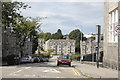
Looking down Caledonian Place, Aberdeen
A small part of Ferryhill Primary School to the right.
Image: © Bill Harrison
Taken: 1 Sep 2012
0.06 miles
10
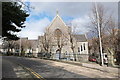
Former Ferryhill North Church
Built in 1877 on a cramped and awkward site by the Aberdeen Church Extension Association to compete with Ferryhill Free Church; now converted to flats.
Image: © Bill Harrison
Taken: 27 Apr 2013
0.07 miles