
IMAGES TAKEN NEAR TO
Bon Accord Street, ABERDEEN, AB11 6EH
Introduction
This page details the photographs taken nearby to Bon Accord Street, AB11 6EH by members of the Geograph project.
The Geograph project started in 2005 with the aim of publishing, organising and preserving representative images for every square kilometre of Great Britain, Ireland and the Isle of Man.

There are currently over 7.5m images from over14,400 individuals and you can help contribute to the project by visiting https://www.geograph.org.uk
Image Map
Images are licensed for reuse under creativecommons.org/licenses/by-sa/2.0
Notes
- Clicking on the map will re-center to the selected point.
- The higher the marker number, the further away the image location is from the centre of the postcode.
Image Listing (272 Images Found)
Images are licensed for reuse under creativecommons.org/licenses/by-sa/2.0
Image
Details
Distance
1
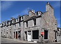
Derelict shops...
...at the corner of Bon Accord Street and Springbank Street. The 1820s terrace as a whole is C-listed (LB20143: http://portal.historicenvironment.scot/designation/LB20143 ) but no details are given.
Image: © Bill Harrison
Taken: 12 Jul 2020
0.01 miles
2
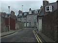
Junction of Bon Accord Crescent and Bon Accord Street
Image: © Steven Brown
Taken: 1 May 2014
0.01 miles
3
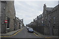
Springbank Street, Aberdeen
Viewed from the west end of the street. This is the "service street" for Springbank Terrace to the south.
Image: © Bill Harrison
Taken: 1 Sep 2012
0.02 miles
4
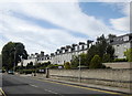
Springbank Terrace (North Side)
Springbank Terrace (also the A93) has an interesting asymmetry with the terrace on the north side (pictured) having large front gardens/parking areas, whereas the similar terrace on the south side of the street faces right onto the pavement. Part of Archibald Simpson's planned developments from ca. 1820s. The whole street is C-listed (downgraded from B): http://www.britishlistedbuildings.co.uk/sc-20510-1-15-inclusive-nos-springbank-terrace-and . This is right on the borderline between city centre and suburb and I've plumped for the latter for its geographical context.
Image: © Bill Harrison
Taken: 1 Sep 2012
0.05 miles
5
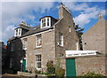
18 Dee Place, Aberdeen
An attractive granite cottage from the 1820s and B-listed: http://www.britishlistedbuildings.co.uk/sc-20257-dee-place-18-
Image: © Bill Harrison
Taken: 20 Sep 2014
0.05 miles
6
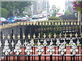
Springbank Terrace
Ornate railings line the pathways leading from the street to the terraced houses in this Aberdeen street. Below the pathways are "the sunks", the basement rooms / flats.
Image: © Colin Smith
Taken: 2 Aug 2011
0.05 miles
8
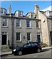
Aberdeen Synagogue, Dee Street, Aberdeen
For the congregation's website, see: http://www.aberdeenhebrew.org.uk/shul.html . The Regency building is B-listed: http://www.britishlistedbuildings.co.uk/sc-20267-dee-street-70-78-even-nos- .
Image: © Bill Harrison
Taken: 20 Sep 2014
0.06 miles
9
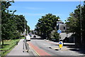
Looking along Willowbank Road (the A93)
The A93, which extends some 177 km from Aberdeen to Perth via Braemar, is one of the most scenic roads in the UK according to the SABRE roads web site: https://www.sabre-roads.org.uk/wiki/index.php?title=A93 .
Image: © Bill Harrison
Taken: 12 Jul 2020
0.06 miles
10
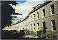
Bon Accord Crescent
This is one of the architect, Archibald Simpson's, best known streets in Aberdeen - built in granite ashlar, and dating from 1823.
Image: © Colin Smith
Taken: Unknown
0.06 miles