IMAGES TAKEN NEAR TO
Regent Road, ABERDEEN, AB11 5NS
Introduction
This page details the photographs taken nearby to Regent Road, AB11 5NS by members of the Geograph project.
The Geograph project started in 2005 with the aim of publishing, organising and preserving representative images for every square kilometre of Great Britain, Ireland and the Isle of Man.

There are currently over 7.5m images from over14,400 individuals and you can help contribute to the project by visiting https://www.geograph.org.uk
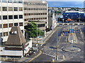
Image Map
Images are licensed for reuse under creativecommons.org/licenses/by-sa/2.0
Notes
- Clicking on the map will re-center to the selected point.
- The higher the marker number, the further away the image location is from the centre of the postcode.
Image Listing (262 Images Found)
Images are licensed for reuse under creativecommons.org/licenses/by-sa/2.0
Image
Details
Distance
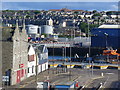
1
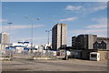
Harbour view, Aberdeen
Salvessen Tower in the centre and to the left, a couple of Northlink ferries bound for the Orkney and Shetland Islands. See: http://www.northlinkferries.co.uk/ for their website.
Image: © Bill Harrison
Taken: 1 Sep 2012
0.02 miles
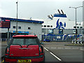
4
Salvesen Tower
The funnels behind the building are of the North Link ferry MV Hrossey, about to depart for Lerwick in the Shetland Islands. Its name means 'Orkney' in Old Norse.
Image: © James Allan
Taken: 2 May 2014
0.04 miles
5
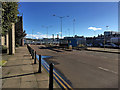
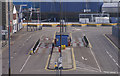
Quarterdeck from Aftdeck
Regent Road from the aft of the Shetland Ferry. The Quarterdeck pub is at bottom left with the foot of Salvesen Tower and the ASCO Centre seen behind it. In the middle is the weighbridge. In the distance is Torry, a residential district in south-east Aberdeen.
Image: © Colin Smith
Taken: 9 Jul 2010
0.04 miles
6
Regent Road
The south end of Regent Road and the Albert Basin as seen from the Shetland Ferry or "North Boat". Around the dock are a mix of old granite buildings, modern high rise developments and North Sea oil industrial areas. In the background is Torry Hill, rising from the granite tenements of Victoria Road to the inter-war developments around the Torry school at Tullos Circle.
Image: © Colin Smith
Taken: 9 Jul 2010
0.04 miles
7
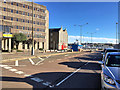
Waiting to board the Shetland ferry
Regent Road, Aberdeen.
Image: © John Lucas
Taken: 20 Jun 2016
0.04 miles
8
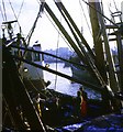
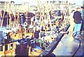
Trawler landing catch at Aberdeen
This picture dates back to the 1960's when Aberdeen was a major white fish port.
Image: © Robert W Watt
Taken: 26 Dec 1967
0.05 miles
9
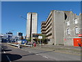
Weighbridge
At Blaikie's Quay in Aberdeen Harbour.
Image: © Mike Pennington
Taken: 13 Apr 2008
0.05 miles
10
Aberdeen Fish Market
Busy mid 1970s scene when Aberdeen still had sizeable fish landings. Today, most of the white fish comes ashore at Fraserburgh and Peterhead where the fishermen can still land their own catch.
http://www.aberdeen-harbour.co.uk
Image: © Colin Smith
Taken: Unknown
0.05 miles