
IMAGES TAKEN NEAR TO
Diamond Lane, ABERDEEN, AB10 1WB
Introduction
This page details the photographs taken nearby to Diamond Lane, AB10 1WB by members of the Geograph project.
The Geograph project started in 2005 with the aim of publishing, organising and preserving representative images for every square kilometre of Great Britain, Ireland and the Isle of Man.

There are currently over 7.5m images from over14,400 individuals and you can help contribute to the project by visiting https://www.geograph.org.uk
Image Map
Images are licensed for reuse under creativecommons.org/licenses/by-sa/2.0
Notes
- Clicking on the map will re-center to the selected point.
- The higher the marker number, the further away the image location is from the centre of the postcode.
Image Listing (802 Images Found)
Images are licensed for reuse under creativecommons.org/licenses/by-sa/2.0
Image
Details
Distance
1
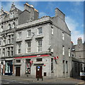
The Colonel's, 152 Union Street, Aberdeen
B-listed from the 1820s: http://data.historic-scotland.gov.uk/pls/htmldb/f?p=2200:15:0::::BUILDING:20560 and once a bank.
Image: © Bill Harrison
Taken: 23 May 2015
0.01 miles
3
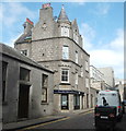
Back-street business
The ground floor of this Scottish baronial style building at the corner of Diamond Street and Diamond Place now houses an "adult store."
Image: © Bill Harrison
Taken: 23 May 2015
0.02 miles
4
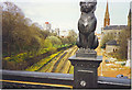
One of Kelly's Cats, Union Bridge.
Above Aberdeen's Denburn Valley, Union Terrace Gardens and the railway line to Inverness. The Denburn Road dual carriageway is under construction (1992).
Image: © Colin Smith
Taken: 1 Apr 1992
0.02 miles
5
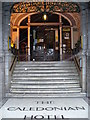
Caledonian Hotel
A welcome sight in a snow storm, or at any other time! This weel kent hotel in Aberdeen's Union Terrace was designed by Mackenzie in the early 19th century.
Image: © Colin Smith
Taken: 24 Mar 2008
0.02 miles
7
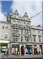
154 Union Street, Aberdeen
This building must feel a bit left-out, as all of its neighbours on Union Street are A- or B-listed. Typical late-Victorian Aberdeen granite exuberance with oriel windows, false balconies (now convenient spots for satellite dishes!), Dutch gables, pinnacles and columns (Pevsner might have raised his eyebrows in terms of Doric above Ionic...) although it pales somewhat compared to the complete over-the-top extravagence of 208 Union Street... See: http://www.geograph.org.uk/photo/3110491
Image: © Bill Harrison
Taken: 1 Sep 2012
0.02 miles
8
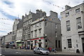
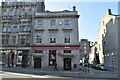
152-158 Union Street, Aberdeen
For a close-up of No. 154, see: http://www.geograph.org.uk/photo/3110486 .
Image: © Bill Harrison
Taken: 1 Sep 2012
0.02 miles
9
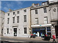
150 and 148 Union Street, Aberdeen
Granite buildings from the 1820s, when Union Street was expanding westwards and possibly designed by Archibald Simpson. 150 (to the left) was once a bank but is now a "champagne bar."
Image: © Bill Harrison
Taken: 23 May 2015
0.02 miles
10
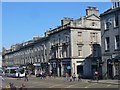
Aberdeen - Union Street
Part of Aberdeen's mile long "granite canyon" of Union Street, here at the Crown Street corner.
Image: © Colin Smith
Taken: 4 Jun 2016
0.03 miles