Thornborough Bridge looking North
Introduction
The photograph on this page of Thornborough Bridge looking North by mick finn as part of the Geograph project.
The Geograph project started in 2005 with the aim of publishing, organising and preserving representative images for every square kilometre of Great Britain, Ireland and the Isle of Man.

There are currently over 7.5m images from over 14,400 individuals and you can help contribute to the project by visiting https://www.geograph.org.uk
Thornborough Bridge looking North
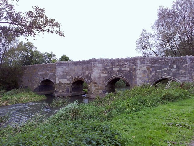
Image: © mick finn Taken: 4 Oct 2008
The medieval bridge (c1400) over the Claydon Brook (a tributary of the Great Ouse) at Thornborough, north Bucks. It is the only extant medieval bridge in Bucks and once formed part of the A421. The road was diverted many years ago to protect this Ancient Monument.
Images are licensed for reuse under creativecommons.org/licenses/by-sa/2.0
Image Location
Latitude
51.992475
Longitude
-0.939705