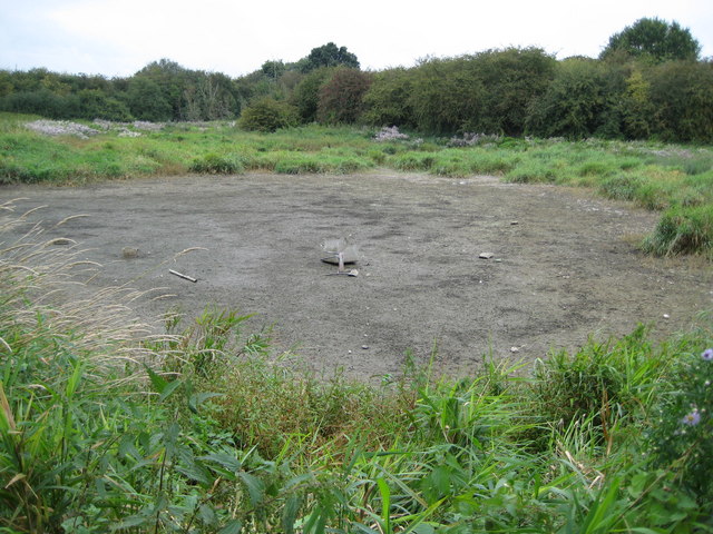
Water End Swallow Holes: Sinkhole basin
Introduction
The photograph on this page of Water End Swallow Holes: Sinkhole basin by Nigel Cox as part of the Geograph project.
The Geograph project started in 2005 with the aim of publishing, organising and preserving representative images for every square kilometre of Great Britain, Ireland and the Isle of Man.
There are currently over 7.5m images from over 14,400 individuals and you can help contribute to the project by visiting https://www.geograph.org.uk

Image: © Nigel Cox Taken: 24 Sep 2008
Please see Image This is the sinkhole basin where surface water accumulates to form a lake during times of flood. As the flood recedes the floodwater gradually drains back into the natural sinks. This is also effectively the source of the River Colne which eventually flows into the River Thames here Image and here Image Someone has considered it to be a good idea to throw an old chair and a large broken plastic container into the middle of the basin.

