Over Marlow gravel pits (1974)
Introduction
The photograph on this page of Over Marlow gravel pits (1974) by Stanley Howe as part of the Geograph project.
The Geograph project started in 2005 with the aim of publishing, organising and preserving representative images for every square kilometre of Great Britain, Ireland and the Isle of Man.

There are currently over 7.5m images from over 14,400 individuals and you can help contribute to the project by visiting https://www.geograph.org.uk
Over Marlow gravel pits (1974)
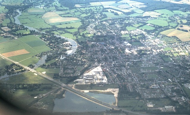
Image: © Stanley Howe Taken: 8 Sep 1974
In the left foreground the Marlow by-pass can be seen crossing the railway line; the part of the pit above the by-pass seems now to have been reclaimed and built upon; the River Thames is making its way from Henley towards London from top to bottom. Shot taken from a TWA flight from LHR to Chicago O'Hare.
Images are licensed for reuse under creativecommons.org/licenses/by-sa/2.0
Image Location
Latitude
51.572865
Longitude
-0.758155