Old Chapel at Hope's Rough
Introduction
The photograph on this page of Old Chapel at Hope's Rough by Bob Embleton as part of the Geograph project.
The Geograph project started in 2005 with the aim of publishing, organising and preserving representative images for every square kilometre of Great Britain, Ireland and the Isle of Man.

There are currently over 7.5m images from over 14,400 individuals and you can help contribute to the project by visiting https://www.geograph.org.uk
Old Chapel at Hope's Rough
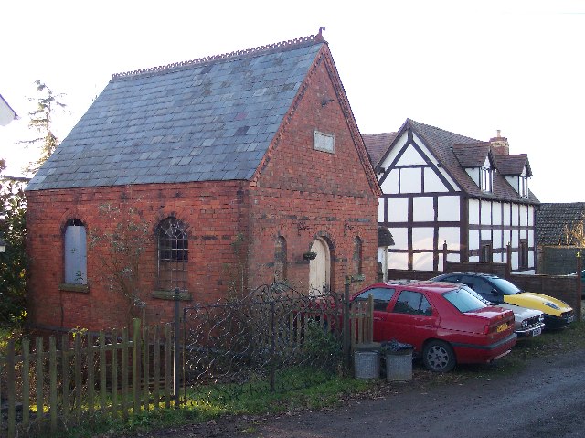
Image: © Bob Embleton Taken: 1 Jan 2006
The chapel appears as a + on the 1940s map. Hope's Rough is a hamlet of a handful of houses. An 1863 Post Office directory mentions a farmer and a shopkeeper located at Hope's Rough. The half-timbered cottage is new.
Images are licensed for reuse under creativecommons.org/licenses/by-sa/2.0
Image Location


Leaflet Map data © OpenStreetMap
Latitude
52.127314
Longitude
-2.530211