Clydebank Railway Station
Introduction
The photograph on this page of Clydebank Railway Station by A-M-Jervis as part of the Geograph project.
The Geograph project started in 2005 with the aim of publishing, organising and preserving representative images for every square kilometre of Great Britain, Ireland and the Isle of Man.

There are currently over 7.5m images from over 14,400 individuals and you can help contribute to the project by visiting https://www.geograph.org.uk
Clydebank Railway Station
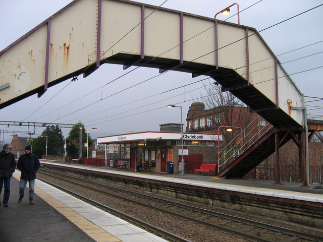
Image: © A-M-Jervis Taken: 15 Dec 2007
In the 1970s the Greater Glasgow Passenger Transport Executive (later renamed Strathclyde P.T.E.) and British Railways set about modernising many of the stations in the Glasgow suburbs and surrounding towns, replacing earlier Victorian buildings with the basic but functional style framed here by the station footbridge. A rectilinear brick or stone-faced box contained staff facilities, booking office and waiting room and the flat roof was extended over the platform as a sheltering canopy. Behind the station building is a remnant of Clydebank's earlier shopping centre, the former Co-operative Society building. The present-day shopping mall, Sylvania Way, is invisible here but stretches away north to and across the canal to the left of the old Co-op.
Images are licensed for reuse under creativecommons.org/licenses/by-sa/2.0
Image Location
Latitude
55.90078
Longitude
-4.403907