Hoxton: The former Hop Pole public house
Introduction
The photograph on this page of Hoxton: The former Hop Pole public house by Nigel Cox as part of the Geograph project.
The Geograph project started in 2005 with the aim of publishing, organising and preserving representative images for every square kilometre of Great Britain, Ireland and the Isle of Man.

There are currently over 7.5m images from over 14,400 individuals and you can help contribute to the project by visiting https://www.geograph.org.uk
Hoxton: The former Hop Pole public house
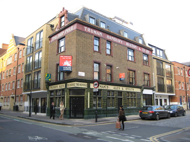
Image: © Nigel Cox Taken: 25 Sep 2008
This former Truman Hanbury Buxton outlet is in Pitfield Street at its junction with Coronet Street. A specialist website listing closed pubs in London describes it as having been closed before 1985 and lying derelict since, which is remarkable when its external condition is considered. Were it not for the estate agents' signs, you would think it was up and running.
Images are licensed for reuse under creativecommons.org/licenses/by-sa/2.0
Image Location
Latitude
51.527458
Longitude
-0.083565