Red Bridge, Redbridge
Introduction
The photograph on this page of Red Bridge, Redbridge by Peter Facey as part of the Geograph project.
The Geograph project started in 2005 with the aim of publishing, organising and preserving representative images for every square kilometre of Great Britain, Ireland and the Isle of Man.

There are currently over 7.5m images from over 14,400 individuals and you can help contribute to the project by visiting https://www.geograph.org.uk
Red Bridge, Redbridge
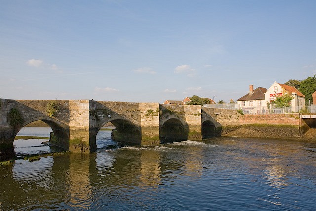
Image: © Peter Facey Taken: 28 Sep 2008
This bridge originally led to the Anchor pub, seen at right, but the road is now blocked off by the railway line. The modern road bridges are behind camera. For the other side of this bridge and its general situation, see Image
Images are licensed for reuse under creativecommons.org/licenses/by-sa/2.0
Image Location
Latitude
50.921669
Longitude
-1.47512