Railway Line and Station at Marchwood
Introduction
The photograph on this page of Railway Line and Station at Marchwood by Peter Facey as part of the Geograph project.
The Geograph project started in 2005 with the aim of publishing, organising and preserving representative images for every square kilometre of Great Britain, Ireland and the Isle of Man.

There are currently over 7.5m images from over 14,400 individuals and you can help contribute to the project by visiting https://www.geograph.org.uk
Railway Line and Station at Marchwood
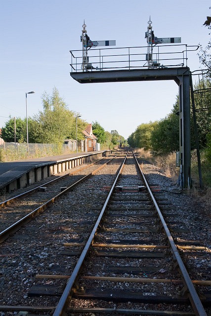
Image: © Peter Facey Taken: 27 Sep 2008
Taken from the level crossing on Main Road. I presume the station is defunct. The railway line forks beyond the horizon, with the left fork going to Marchwood Military Port and the right one going to Fawley oil refinery. Note the old fashioned moving-arm signalling and the lack of any electrification.
Images are licensed for reuse under creativecommons.org/licenses/by-sa/2.0
Image Location


Leaflet Map data © OpenStreetMap
Latitude
50.888755
Longitude
-1.455159