Bray: High Street
Introduction
The photograph on this page of Bray: High Street by Nigel Cox as part of the Geograph project.
The Geograph project started in 2005 with the aim of publishing, organising and preserving representative images for every square kilometre of Great Britain, Ireland and the Isle of Man.

There are currently over 7.5m images from over 14,400 individuals and you can help contribute to the project by visiting https://www.geograph.org.uk
Bray: High Street
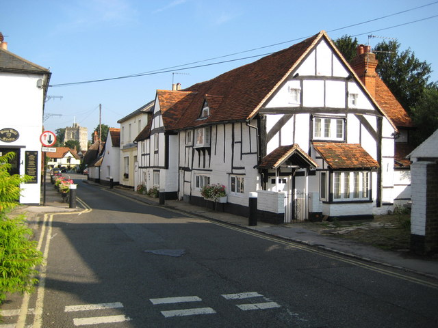
Image: © Nigel Cox Taken: 14 Sep 2008
The narrowness of Bray's High Street here has necessitated the introduction of a traffic restriction with priority given to vehicles coming in the opposite direction. The front doors of the half-timbered houses on the right that face out onto the street are so low that the lintels are below the shoulder height of an average man. Image is visible in the distance.
Images are licensed for reuse under creativecommons.org/licenses/by-sa/2.0
Image Location


Leaflet Map data © OpenStreetMap
Latitude
51.507239
Longitude
-0.701438